MyTopo
Cambridge Nebraska US Topo Map
Couldn't load pickup availability
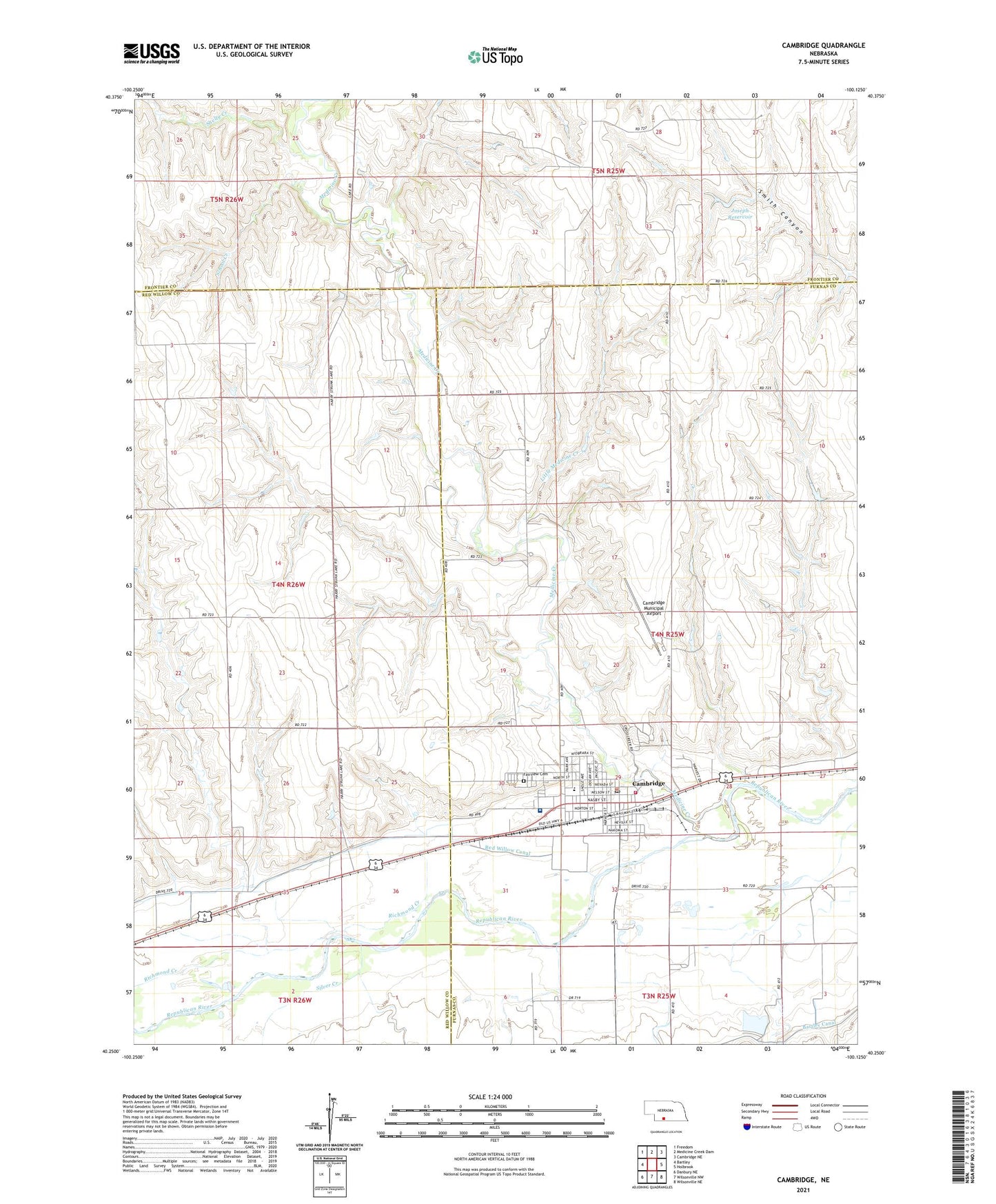
2021 topographic map quadrangle Cambridge in the state of Nebraska. Scale: 1:24000. Based on the newly updated USGS 7.5' US Topo map series, this map is in the following counties: Furnas, Red Willow, Frontier. The map contains contour data, water features, and other items you are used to seeing on USGS maps, but also has updated roads and other features. This is the next generation of topographic maps. Printed on high-quality waterproof paper with UV fade-resistant inks.
Quads adjacent to this one:
West: Bartley
Northwest: Freedom
North: Medicine Creek Dam
Northeast: Cambridge NE
East: Holbrook
Southeast: Wilsonville NE
South: Wilsonville NW
Southwest: Danbury NE
Contains the following named places: Butler Memorial Library, Calvary Baptist Church, Cambridge, Cambridge City Park, Cambridge City Park Campground, Cambridge Election Precinct, Cambridge Golf Course, Cambridge Medical Clinic, Cambridge Memorial Hospital Heliport, Cambridge Municipal Airport, Cambridge Museum, Cambridge Police Department, Cambridge Post Office, Cambridge Public Schools, Cambridge Rescue Service, Cambridge Volunteer Fire Department, City of Cambridge, Congregational Church, Fairview Cemetery, Harding School Number 70, Heritage Plaza Retirement Village, Jones and Cope Dental Clinic, Joseph Dam, Joseph Reservoir, Little Medicine Creek, Medicine Creek, Mount Zion School, Mousel School, Nebraska Urology Center, North Valley School, Parkside Manor, Progressive Family Medical Associates, Richmond Creek, Saint John Catholic Church, Saint Pauls Lutheran Church, School Creek, Shelly Creek, Silver Creek, Tri - Valley Health System Cambridge Memorial Hospital, Tri-Valley Physical Therapy, United Methodist Church