MyTopo
Card Lake Nebraska US Topo Map
Couldn't load pickup availability
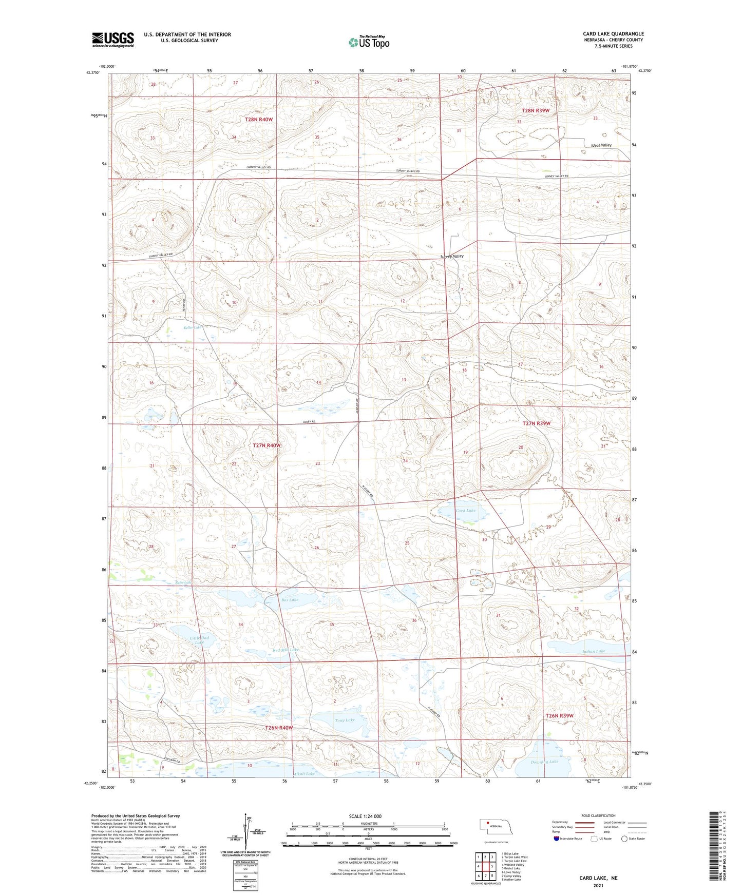
2021 topographic map quadrangle Card Lake in the state of Nebraska. Scale: 1:24000. Based on the newly updated USGS 7.5' US Topo map series, this map is in the following counties: Cherry. The map contains contour data, water features, and other items you are used to seeing on USGS maps, but also has updated roads and other features. This is the next generation of topographic maps. Printed on high-quality waterproof paper with UV fade-resistant inks.
Quads adjacent to this one:
West: Wolford Valley
Northwest: Billys Lake
North: Turpin Lake West
Northeast: Turpin Lake East
East: Bristol Lake
Southeast: Mother Lake
South: Camp Valley
Southwest: Lowe Valley
Contains the following named places: Bos Lake, Bos Ranch, Card Lake, Card Ranch, Downing Lake, F Gibson Ranch, Frye Ranch, Ideal Valley, Indian Lake, Jamison Ranch, K King Ranch, Keller Lake, King Election Precinct, Kingsbury Ranch, Little Dad Lake, Lowe Ranch, Nelse Lake, Red Mill Lake, School Number 114, School Number 150, School Number 168, Survey Valley, Tony Lake, Winston Ranch