MyTopo
Turpin Lake East Nebraska US Topo Map
Couldn't load pickup availability
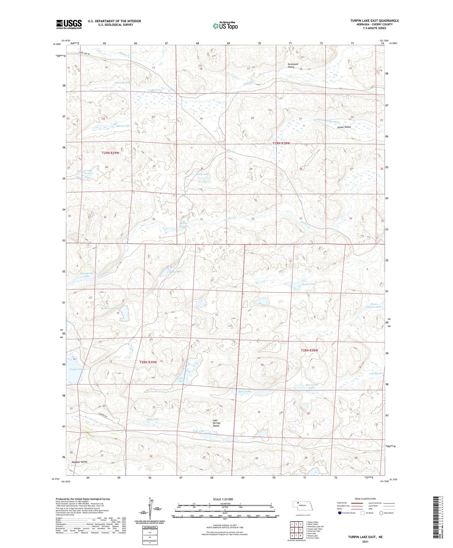
2021 topographic map quadrangle Turpin Lake East in the state of Nebraska. Scale: 1:24000. Based on the newly updated USGS 7.5' US Topo map series, this map is in the following counties: Cherry. The map contains contour data, water features, and other items you are used to seeing on USGS maps, but also has updated roads and other features. This is the next generation of topographic maps. Printed on high-quality waterproof paper with UV fade-resistant inks.
Quads adjacent to this one:
West: Turpin Lake West
Northwest: Gypsy Valley
North: North Valley
Northeast: Wild Mare Lake SW
East: Steverson Lake
Southeast: Carrico Lakes
South: Bristol Lake
Southwest: Card Lake
This map covers the same area as the classic USGS quad with code o42101d7.
Contains the following named places: Adam Ranch, Blue Crane Lake, Bobtail Lake, Chamberlin Lake, Dead Cow Lake, Dillie Lake, Edwards Lake, Ell Lake, Frye Lake, Gordon Valley Dam, Gordon Valley Reservoir, Holst Lake, James Valley, Lake Springs Valley, Mally Lake, Marty Lake, Ruby Lake, School Number 162, Steve Lake, Tennessee Valley, Thirty-Six Lake, Turpin Lake