MyTopo
Turpin Lake West Nebraska US Topo Map
Couldn't load pickup availability
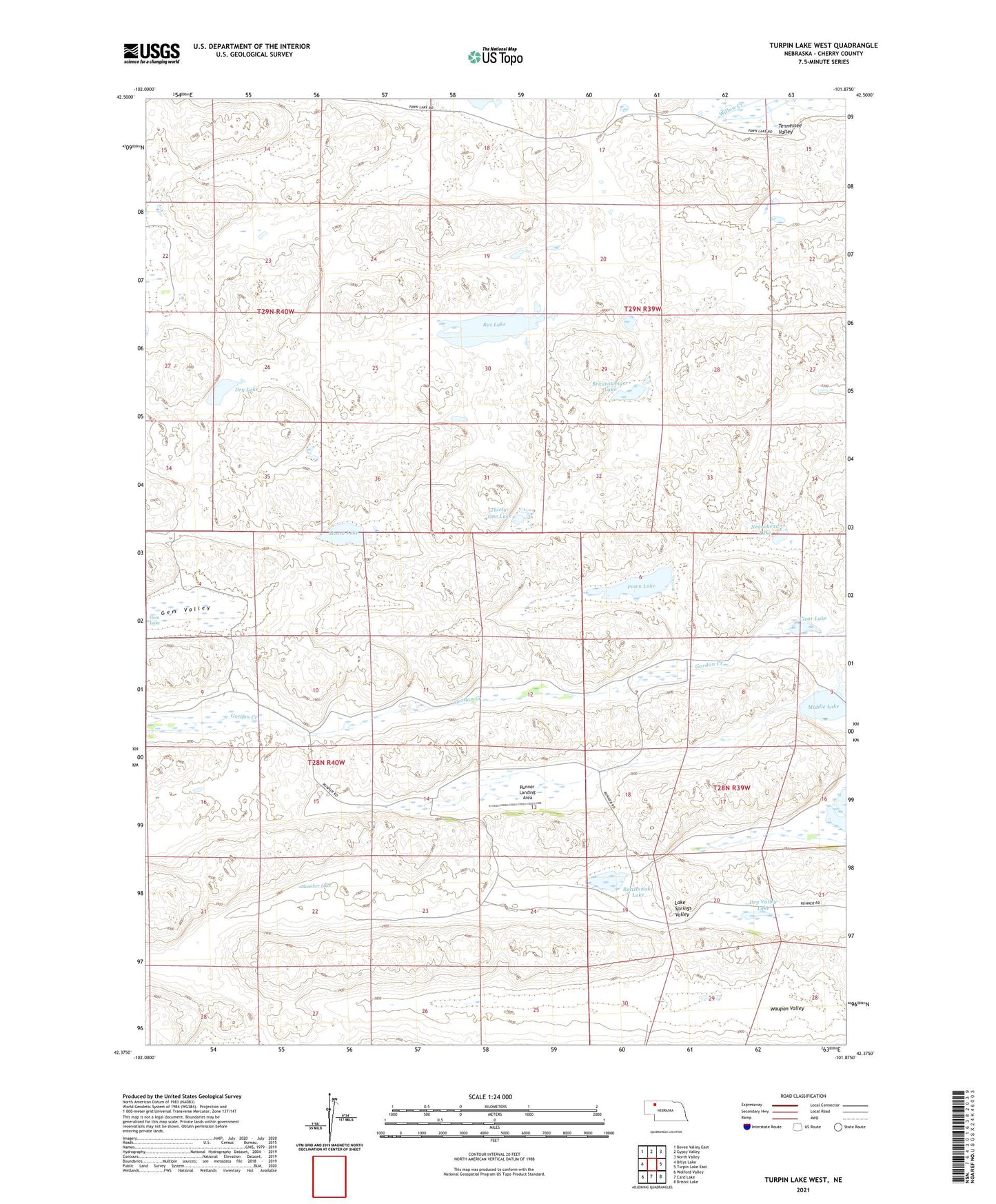
2021 topographic map quadrangle Turpin Lake West in the state of Nebraska. Scale: 1:24000. Based on the newly updated USGS 7.5' US Topo map series, this map is in the following counties: Cherry. The map contains contour data, water features, and other items you are used to seeing on USGS maps, but also has updated roads and other features. This is the next generation of topographic maps. Printed on high-quality waterproof paper with UV fade-resistant inks.
Quads adjacent to this one:
West: Billys Lake
Northwest: Bovee Valley East
North: Gypsy Valley
Northeast: North Valley
East: Turpin Lake East
Southeast: Bristol Lake
South: Card Lake
Southwest: Wolford Valley
This map covers the same area as the classic USGS quad with code o42101d8.
Contains the following named places: Adam Ranch, Beckwith Ranch, Blaine Runner Ranch, Bob Runner Ranch, Braunsweiger Lake, Cedar Lake, Clear Lake, Dry Lake, Dry Valley Lake, Fawn Lake, Gem Lake, Gem Valley, Gordon Creek School, Gordon Valley Church, J Westover Ranch, K King Ranch, Middle Lake, Moore Lake, Negrohead Lake, Rat Lake, Rattlesnake Lake, Runner Landing Area, Slonaker Lake, Thirty-One Lake, U Cross Ranch, U-Cross Ranch, Waupan Valley