MyTopo
Clearwater Nebraska US Topo Map
Couldn't load pickup availability
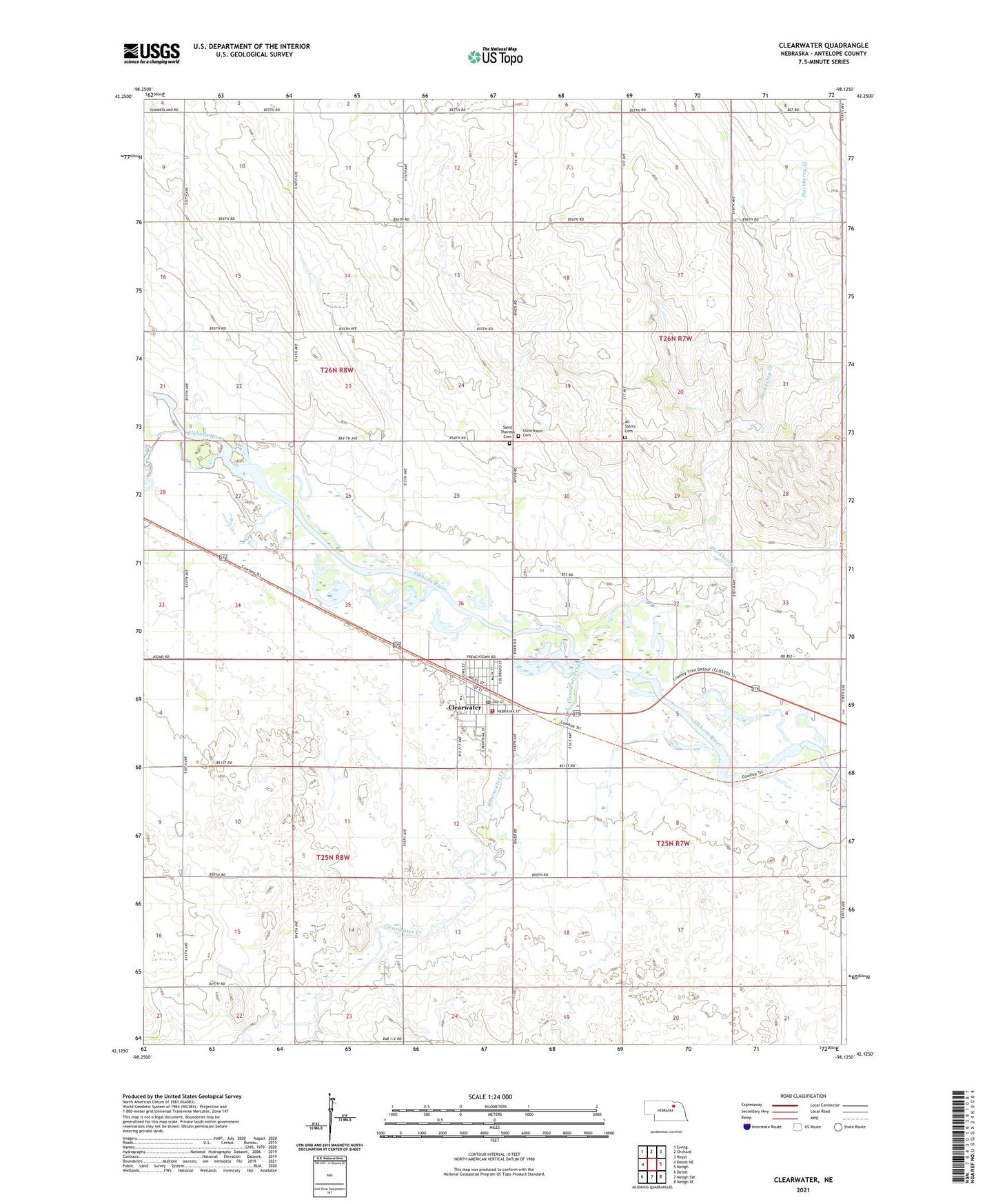
2021 topographic map quadrangle Clearwater in the state of Nebraska. Scale: 1:24000. Based on the newly updated USGS 7.5' US Topo map series, this map is in the following counties: Antelope. The map contains contour data, water features, and other items you are used to seeing on USGS maps, but also has updated roads and other features. This is the next generation of topographic maps. Printed on high-quality waterproof paper with UV fade-resistant inks.
Quads adjacent to this one:
West: Deloit NE
Northwest: Ewing
North: Orchard
Northeast: Royal
East: Neligh
Southeast: Neligh SE
South: Neligh SW
Southwest: Deloit
Contains the following named places: All Saints Cemetery, Clearwater, Clearwater Cemetery, Clearwater Creek, Clearwater Post Office, Clearwater Public Library, Clearwater Public Schools, Clearwater Volunteer Fire Department, Condordia Lutheran Church, Hackberry Creek, Hackberry Creek State Wildlife Management Area, Reorganized Church of Latter Day Saints, Saint Theresa Catholic Church, Saint Theresa Cemetery, School Number 8, Snake Creek, Township of Blaine, Township of Clearwater, Township of Frenchtown, Township of Ord, United Methodist Church, Village of Clearwater, ZIP Code: 68726