MyTopo
Ewing Nebraska US Topo Map
Couldn't load pickup availability
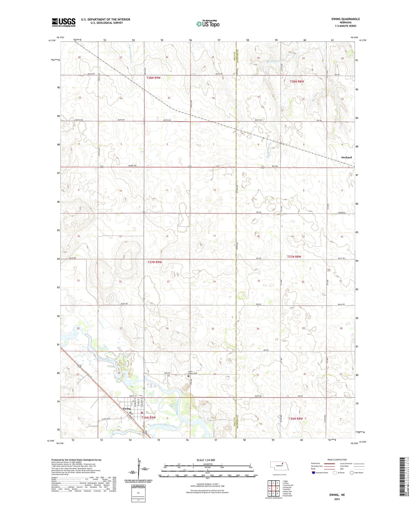
2021 topographic map quadrangle Ewing in the state of Nebraska. Scale: 1:24000. Based on the newly updated USGS 7.5' US Topo map series, this map is in the following counties: Holt, Antelope. The map contains contour data, water features, and other items you are used to seeing on USGS maps, but also has updated roads and other features. This is the next generation of topographic maps. Printed on high-quality waterproof paper with UV fade-resistant inks.
Quads adjacent to this one:
West: Ewing SW
Northwest: Page
North: Venus
Northeast: Orchard NW
East: Orchard
Southeast: Clearwater
South: Deloit NE
Southwest: Deloit NW
This map covers the same area as the classic USGS quad with code o42098c3.
Contains the following named places: Church of Christ, Emporia School, Ewing, Ewing Clinic, Ewing Library, Ewing Police Department, Ewing Post Office, Ewing Public Schools, Ewing Volunteer Fire and Rescue, Full Gospel Church, Saint Peters Cemetery, Saint Peters Church, Savidge Brothers Aviation Pioneers Historical Marker, School Number 173, South Fork Elkhorn River, United Methodist Presbyterian Church, Village of Ewing