MyTopo
Orchard Nebraska US Topo Map
Couldn't load pickup availability
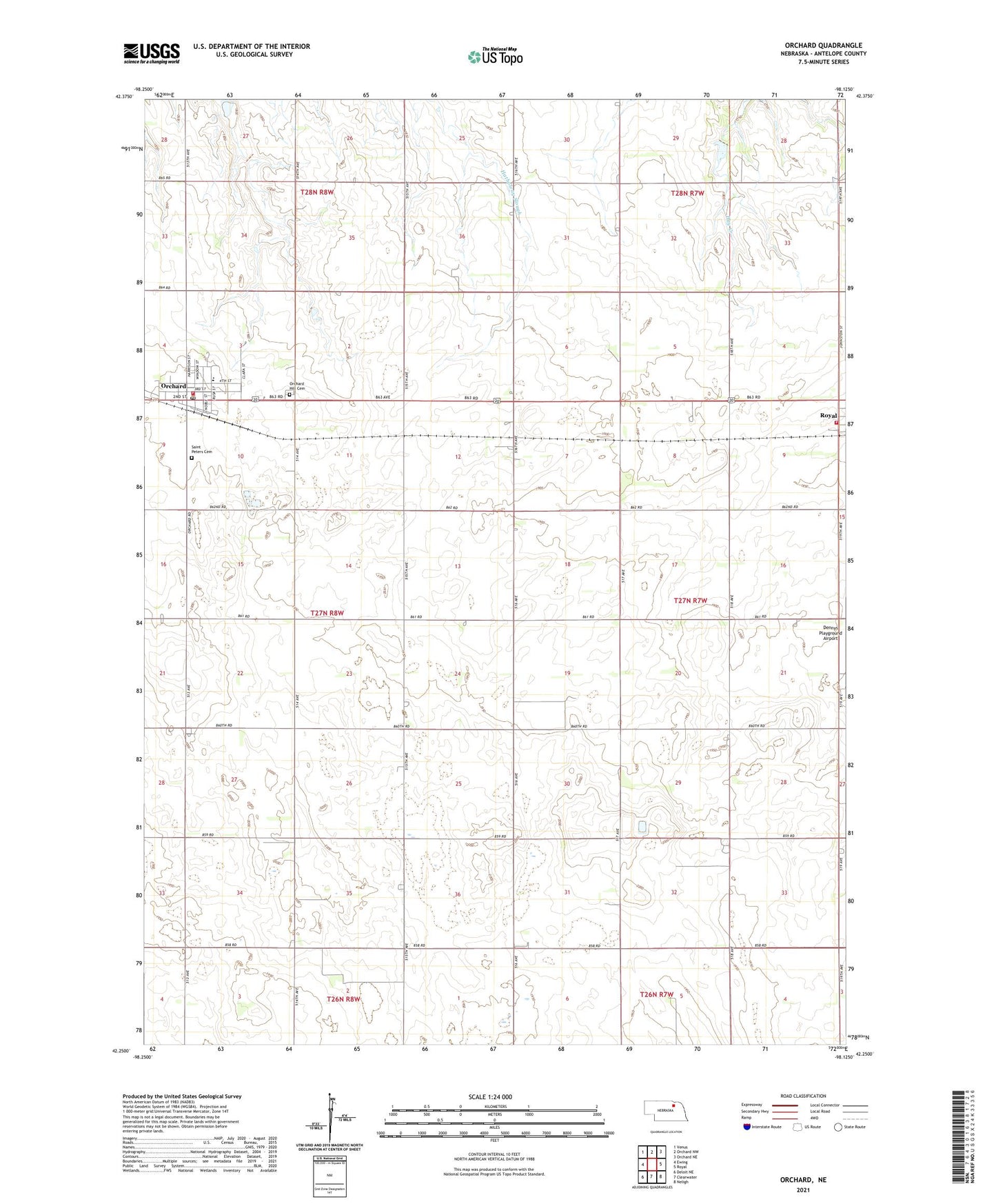
2021 topographic map quadrangle Orchard in the state of Nebraska. Scale: 1:24000. Based on the newly updated USGS 7.5' US Topo map series, this map is in the following counties: Antelope. The map contains contour data, water features, and other items you are used to seeing on USGS maps, but also has updated roads and other features. This is the next generation of topographic maps. Printed on high-quality waterproof paper with UV fade-resistant inks.
Quads adjacent to this one:
West: Ewing
Northwest: Venus
North: Orchard NW
Northeast: Orchard NE
East: Royal
Southeast: Neligh
South: Clearwater
Southwest: Deloit NE
This map covers the same area as the classic USGS quad with code o42098c2.
Contains the following named places: Dennys Playground Airport, Evangelical Free Church, Highland School, North Star School, Orchard, Orchard Hill Cemetery, Orchard Medical Center, Orchard Medical Clinic, Orchard Post Office, Orchard Public Library, Orchard Public Schools, Orchard Volunteer Fire Department, Peavey Company Elevator, Prairie States Forestry Project Historical Marker, Royal, Royal Volunteer Fire Department, Saint Peters Cemetery, Saint Peters Lutheran Church, Schleusener Dam, Schleusener Reservoir, Township of Garfield, Township of Royal, United Methodist Church, Village of Orchard, Village of Royal