MyTopo
Rogers Nebraska US Topo Map
Couldn't load pickup availability
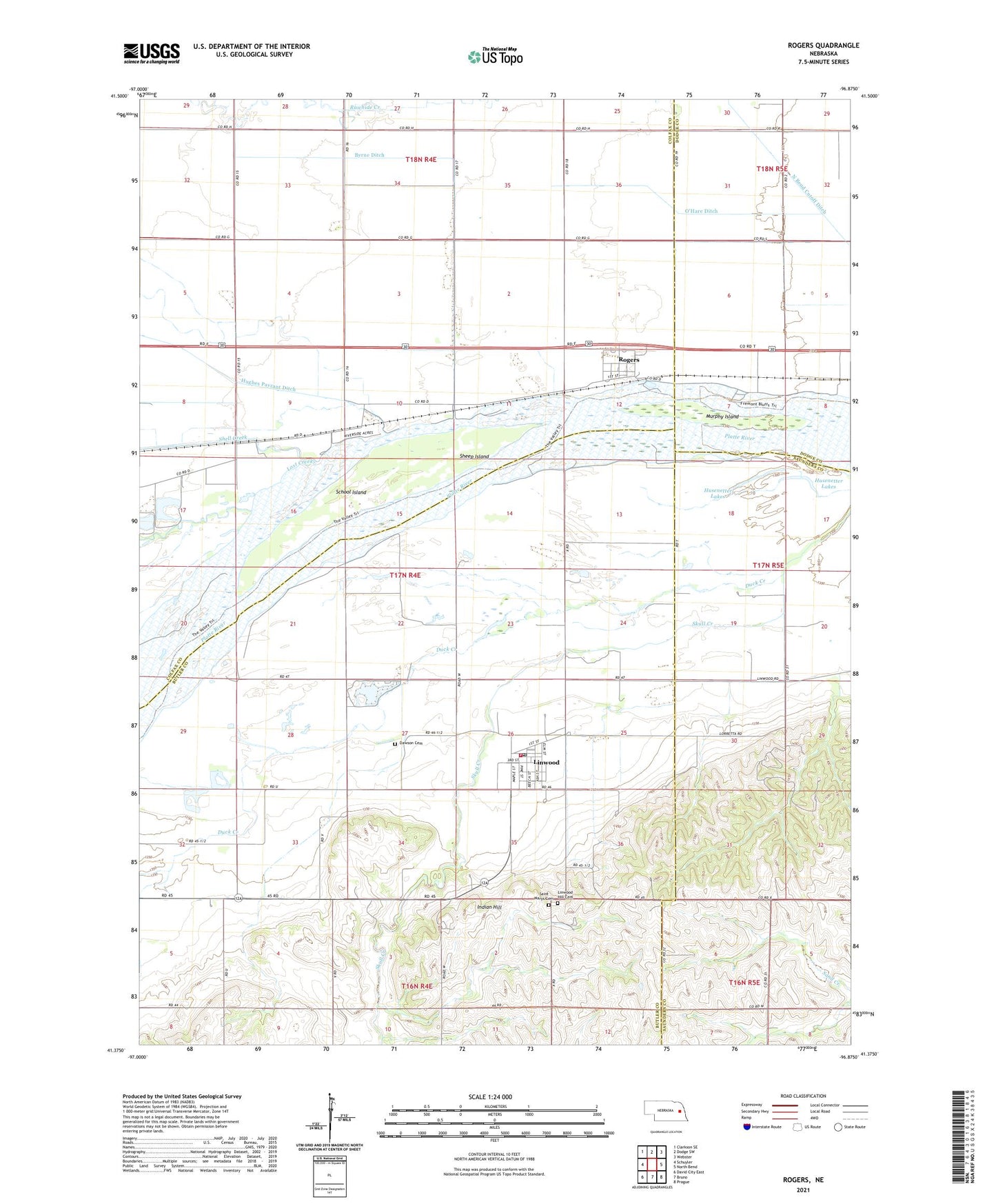
2021 topographic map quadrangle Rogers in the state of Nebraska. Scale: 1:24000. Based on the newly updated USGS 7.5' US Topo map series, this map is in the following counties: Butler, Colfax, Saunders, Dodge. The map contains contour data, water features, and other items you are used to seeing on USGS maps, but also has updated roads and other features. This is the next generation of topographic maps. Printed on high-quality waterproof paper with UV fade-resistant inks.
Quads adjacent to this one:
West: Schuyler
Northwest: Clarkson SE
North: Dodge SW
Northeast: Webster
East: North Bend
Southeast: Prague
South: Bruno
Southwest: David City East
This map covers the same area as the classic USGS quad with code o41096d8.
Contains the following named places: Byrne Ditch, Camp Moses Merrill, Dawson Cemetery, Duck Creek, Hayland, Husenetter Lakes, Indian Hill, Linwood, Linwood Hill Cemetery, Linwood Post Office, Linwood Public School, Linwood Volunteer Fire Department, Lost Creek, Murphy Island, O'Hare Ditch, Rogers, Rogers Election Precinct, Rogers Post Office, Saint Marys Cemetery, School Island, School Number 10, School Number 4-R, School Number 86, Sheep Island, Shell Creek, Township of Platte, Township of Rogers, Village of Linwood, Village of Rogers, ZIP Code: 68036