MyTopo
Diller Nebraska US Topo Map
Couldn't load pickup availability
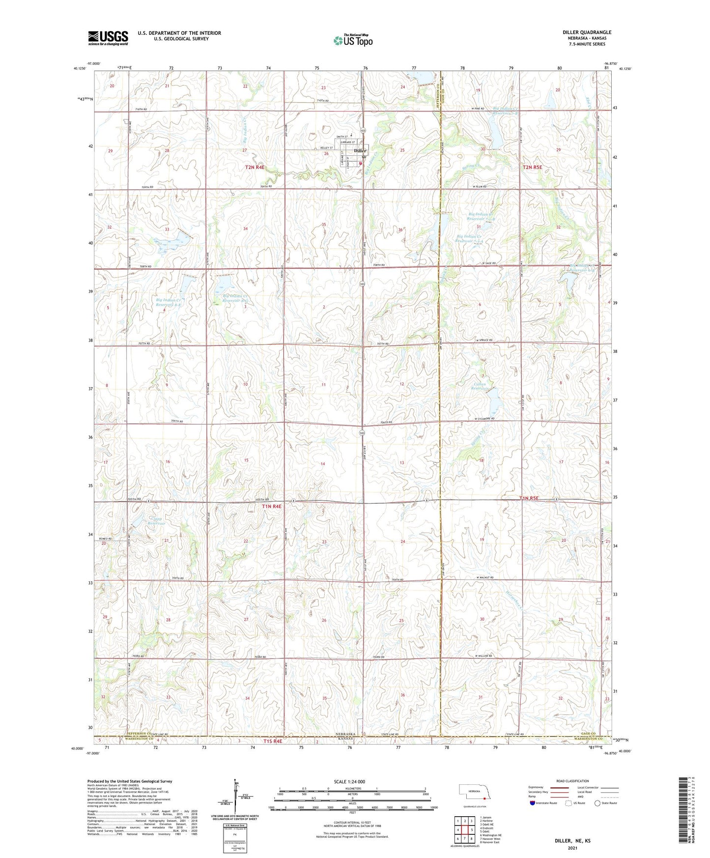
2021 topographic map quadrangle Diller in the states of Nebraska, Kansas. Scale: 1:24000. Based on the newly updated USGS 7.5' US Topo map series, this map is in the following counties: Jefferson, Gage, Washington. The map contains contour data, water features, and other items you are used to seeing on USGS maps, but also has updated roads and other features. This is the next generation of topographic maps. Printed on high-quality waterproof paper with UV fade-resistant inks.
Quads adjacent to this one:
West: Endicott
Northwest: Jansen
North: Harbine
Northeast: Odell NE
East: Odell
Southeast: Hanover East
South: Hanover West
Southwest: Washington NE
Contains the following named places: Big Indian Creek Dam 6-B, Big Indian Creek Dam 7-1-A, Big Indian Creek Dam 7-1-B, Big Indian Creek Dam 7-B, Big Indian Creek Reservoir, Big Indian Creek Reservoir 17-A, Big Indian Creek Reservoir 6-B, Big Indian Creek Reservoir 7-1-A, Big Indian Creek Reservoir 7-1-B, Big Indian Creek Reservoir 7-A, Big Indian Creek Reservoir 7-B, Big Indian Creek Reservoir 8-E, Big Indian Creek Reservoir 8-F, Big Indian Creek Reservoir 8-G, Callan Dam, Callan Lake, Callan Reservoir, Clapp Dam, Clapp Reservoir, Detention Dam 17-A, Detention Dam 7-A, Diller, Diller Campground, Diller City Park, Diller Community School, Diller Historical Marker, Diller Post Office, Diller Rural Fire and Rescue, Firth Cooperative Elevator, Floodwater Retarding Dam 8-E, Floodwater Retarding Dam 8-F, Floodwater Retarding Dam 8-G, Newton Election Precinct, Pleasant View School, Pretzer Hog Farm, Saint Pauls Lutheran Church, Spring Creek, Township of Newton, Village of Diller, Zion Evangelical Lutheran Church, ZIP Code: 68342