MyTopo
Jansen Nebraska US Topo Map
Couldn't load pickup availability
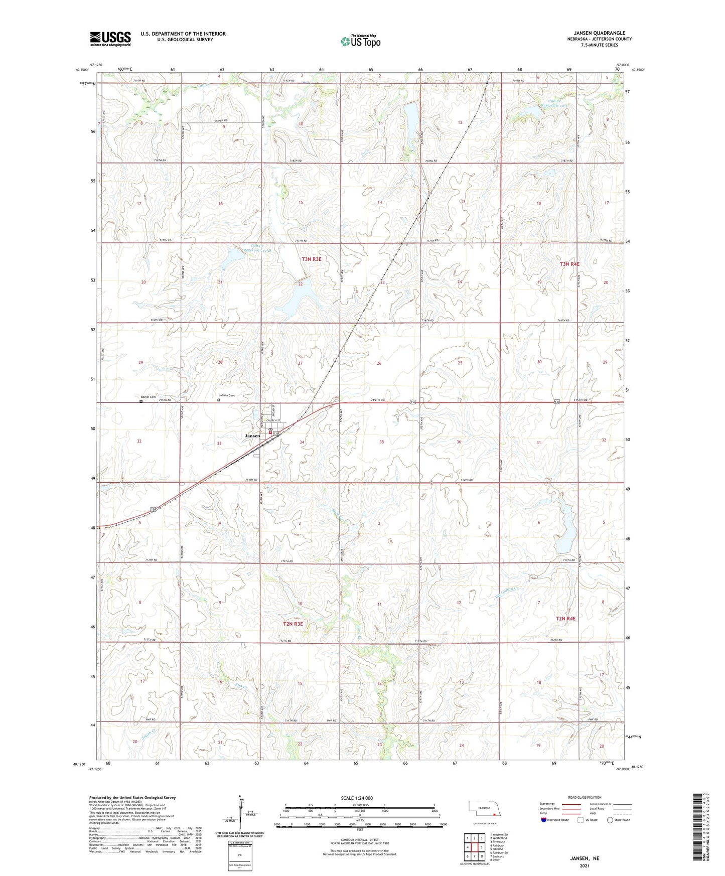
2021 topographic map quadrangle Jansen in the state of Nebraska. Scale: 1:24000. Based on the newly updated USGS 7.5' US Topo map series, this map is in the following counties: Jefferson. The map contains contour data, water features, and other items you are used to seeing on USGS maps, but also has updated roads and other features. This is the next generation of topographic maps. Printed on high-quality waterproof paper with UV fade-resistant inks.
Quads adjacent to this one:
West: Fairbury
Northwest: Western SW
North: Western SE
Northeast: Plymouth
East: Harbine
Southeast: Diller
South: Endicott
Southwest: Fairbury SW
This map covers the same area as the classic USGS quad with code o40097b1.
Contains the following named places: Bartel Cemetery, Big Indian Creek Reservoir 10-A, Cub Creek, Cub Creek Dam 13-C, Cub Creek Dam 14-A, Cub Creek Election Precinct, Cub Creek Reservoir 10-C, Cub Creek Reservoir 12-A, Cub Creek Reservoir 13-C, Cub Creek Reservoir 13-D, Detention Dam 10-A, Detention Dam 10-C, Farmers Co-op Elevator, Floodwater Retarding Dam 12-A, Floodwater Retarding Dam 13-D, Grandy School, Jansen, Jansen Bible Church, Jansen Cemetery, Jansen Historical Marker, Jansen Post Office, Jansen Rural Fire Department, KUTT-FM (Fairbury), Mennonite Church, Rock Creek Election Precinct, Township of Cub Creek, Township of Rock Creek, Village of Jansen, ZIP Code: 68377