MyTopo
Staplehurst Nebraska US Topo Map
Couldn't load pickup availability
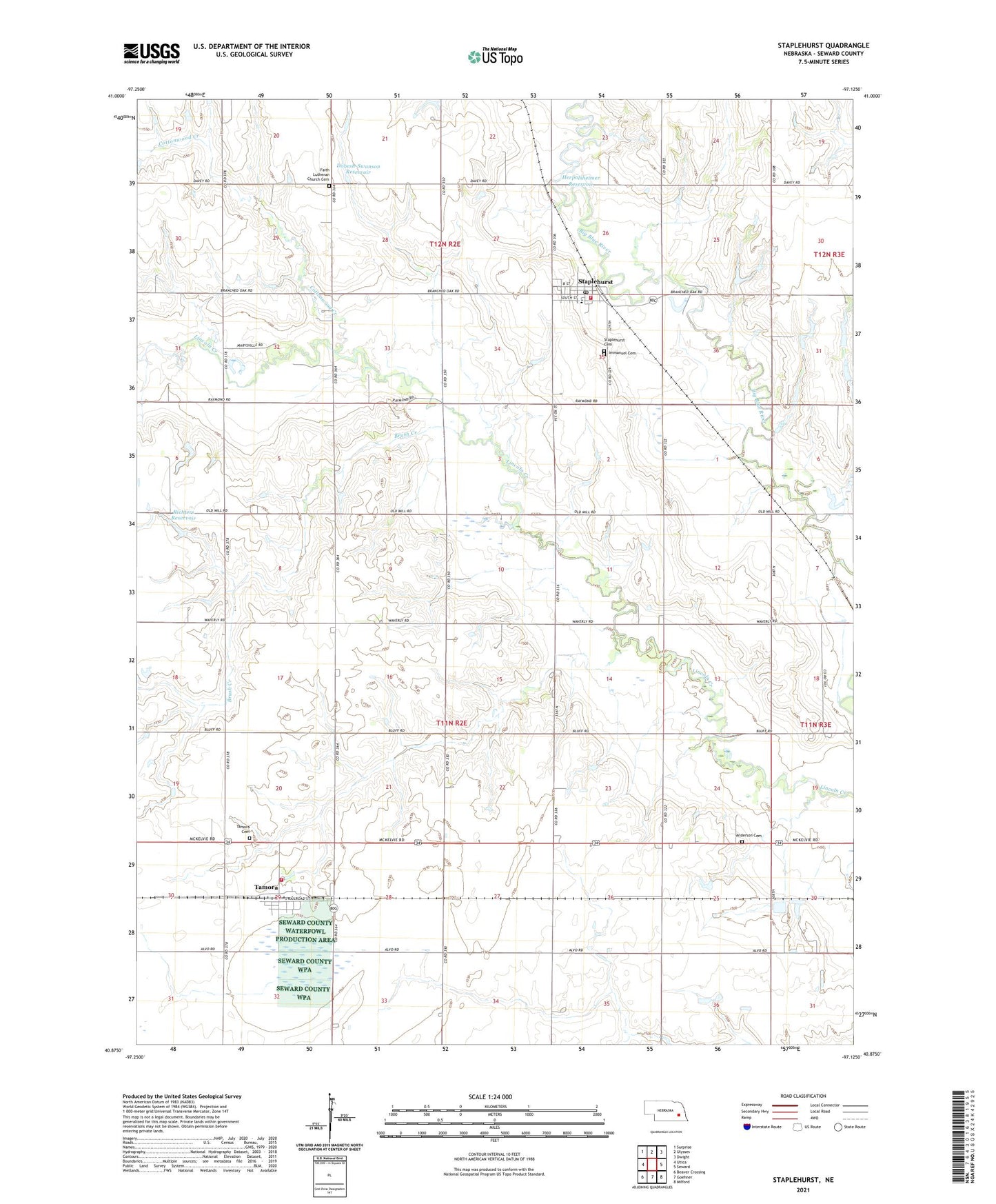
2021 topographic map quadrangle Staplehurst in the state of Nebraska. Scale: 1:24000. Based on the newly updated USGS 7.5' US Topo map series, this map is in the following counties: Seward. The map contains contour data, water features, and other items you are used to seeing on USGS maps, but also has updated roads and other features. This is the next generation of topographic maps. Printed on high-quality waterproof paper with UV fade-resistant inks.
Quads adjacent to this one:
West: Utica
Northwest: Surprise
North: Ulysses
Northeast: Dwight
East: Seward
Southeast: Milford
South: Goehner
Southwest: Beaver Crossing
This map covers the same area as the classic USGS quad with code o40097h2.
Contains the following named places: Anderson Cemetery, Blue Valley Cooperative Elevator, Briggs Feed Yard, Brush Creek, Cottonwood Creek, Dobesh-Swanson Dam, Dobesh-Swanson Reservoir, Election Precinct F, Faith Lutheran Church Cemetery, Herpolsheimer Dam, Herpolsheimer Reservoir, Immanuel Cemetery, Marysville, Marysville Post Office, Our Redeemer Lutheran Church, Our Redeemer Lutheran Elementary School, Richters Dam, Richters Reservoir, Staplehurst, Staplehurst Cemetery, Staplehurst Police Department, Staplehurst Post Office, Staplehurst Volunteer Fire Department, Tamora, Tamora Cemetery, Tamora Census Designated Place, Tamora Post Office, Tamora Volunteer Fire Department, Township F, Village of Staplehurst, Zion School, ZIP Code: 68439