MyTopo
Edgar Nebraska US Topo Map
Couldn't load pickup availability
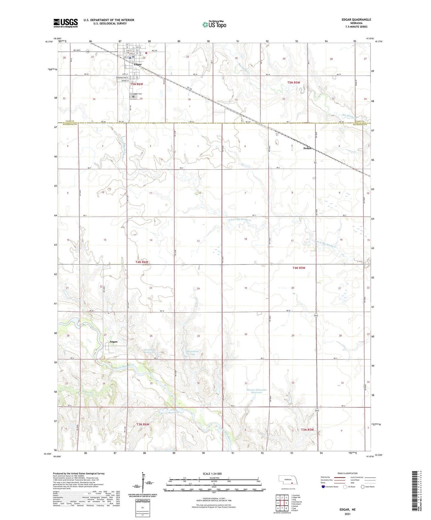
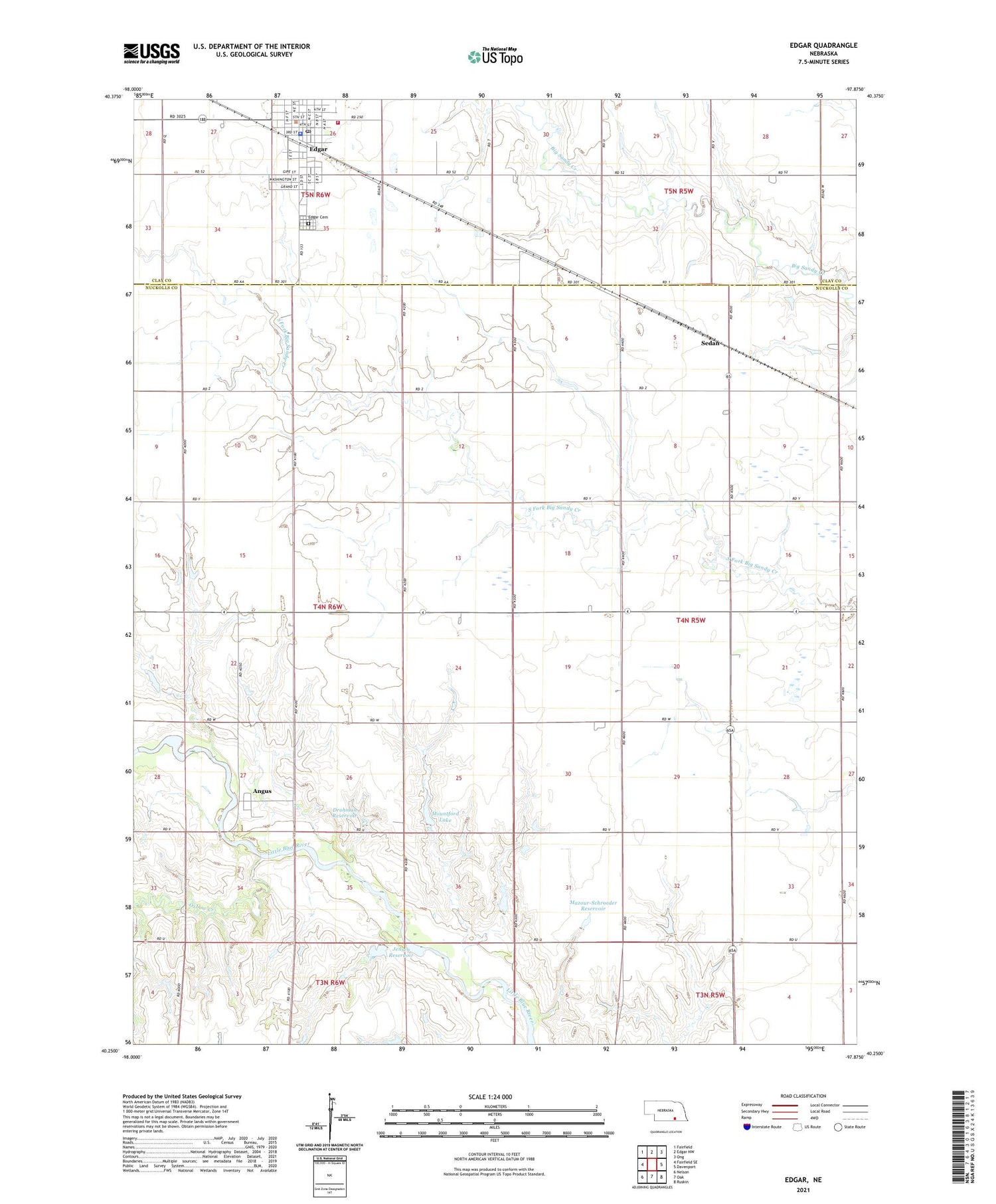
2021 topographic map quadrangle Edgar in the state of Nebraska. Scale: 1:24000. Based on the newly updated USGS 7.5' US Topo map series, this map is in the following counties: Nuckolls, Clay. The map contains contour data, water features, and other items you are used to seeing on USGS maps, but also has updated roads and other features. This is the next generation of topographic maps. Printed on high-quality waterproof paper with UV fade-resistant inks.
Quads adjacent to this one:
West: Fairfield SE
Northwest: Fairfield
North: Edgar NW
Northeast: Ong
East: Davenport
Southeast: Ruskin
South: Oak
Southwest: Nelson
Contains the following named places: Angus, Angus Post Office, Aurora Cooperative Elevator Company Elevator, Church of the Plains, City of Edgar, Community Care of Edgar, Drohman Dam-1 Dam, Drohman Reservoir, Edgar, Edgar Cemetery, Edgar Christian Church, Edgar Grain and Supply Company Elevator, Edgar Lutheran Church, Edgar Police Department, Edgar Post Office, Edgar Volunteer Fire and Rescue, Elk Election Precinct, Jensen Dam, Jensen Reservoir, Mazour-Schroeder Dam, Mazour-Schroeder Reservoir, Mountford Dam, Mountford Lake, Oxbow Creek, Pioneer School, Sedan, Sedan Post Office, Sedan School, Sherman Election Precinct, South Park, Standpipe Park, Sugden Health Center, Township of Sherman