MyTopo
Davenport Nebraska US Topo Map
Couldn't load pickup availability
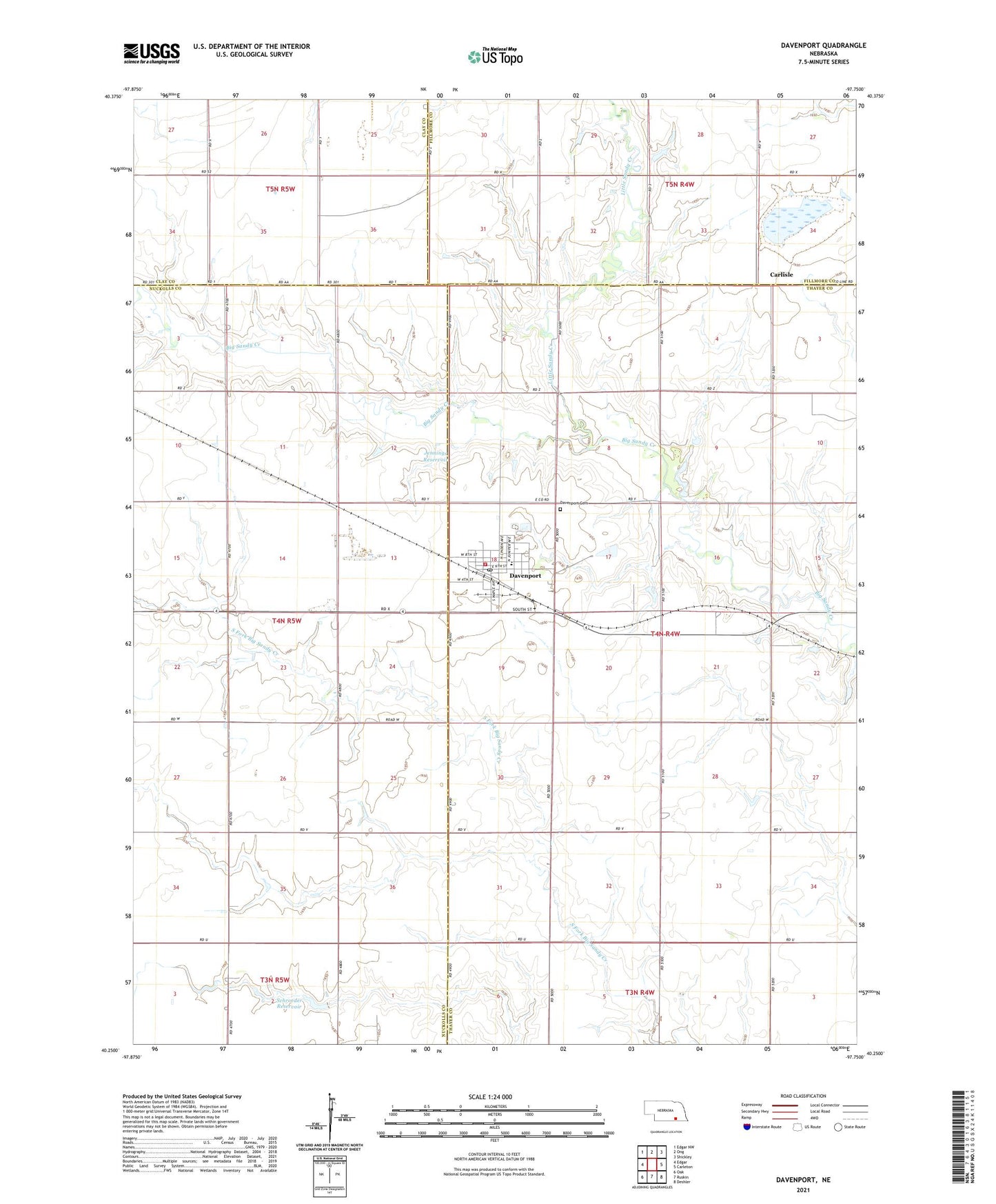
2021 topographic map quadrangle Davenport in the state of Nebraska. Scale: 1:24000. Based on the newly updated USGS 7.5' US Topo map series, this map is in the following counties: Thayer, Nuckolls, Fillmore, Clay. The map contains contour data, water features, and other items you are used to seeing on USGS maps, but also has updated roads and other features. This is the next generation of topographic maps. Printed on high-quality waterproof paper with UV fade-resistant inks.
Quads adjacent to this one:
West: Edgar
Northwest: Edgar NW
North: Ong
Northeast: Shickley
East: Carleton
Southeast: Deshler
South: Ruskin
Southwest: Oak
This map covers the same area as the classic USGS quad with code o40097c7.
Contains the following named places: Carlisle, Carlisle Post Office, Christs Lutheran Church, Davenport, Davenport Community Schools, Davenport Medical Clinic, Davenport Post Office, Davenport Public Library, Davenport Volunteer Fire and Rescue, Grone Airport, Hammond Election Precinct, Happy Hollow School, Jagels Dam, Jagels Reservoir, Jennings Dam, Jennings Reservoir, Little Sandy Creek, Pleasant Hill School, R and R Farms Airport, Saint Peters Lutheran Church, Saint Peters Lutheran Elementary School, Schroeder Dam, Schroeder Reservoir, Township of Davenport, Township of Hammond, United Methodist Church, Valley View School, Village of Davenport, ZIP Code: 68335