MyTopo
Ruskin Nebraska US Topo Map
Couldn't load pickup availability
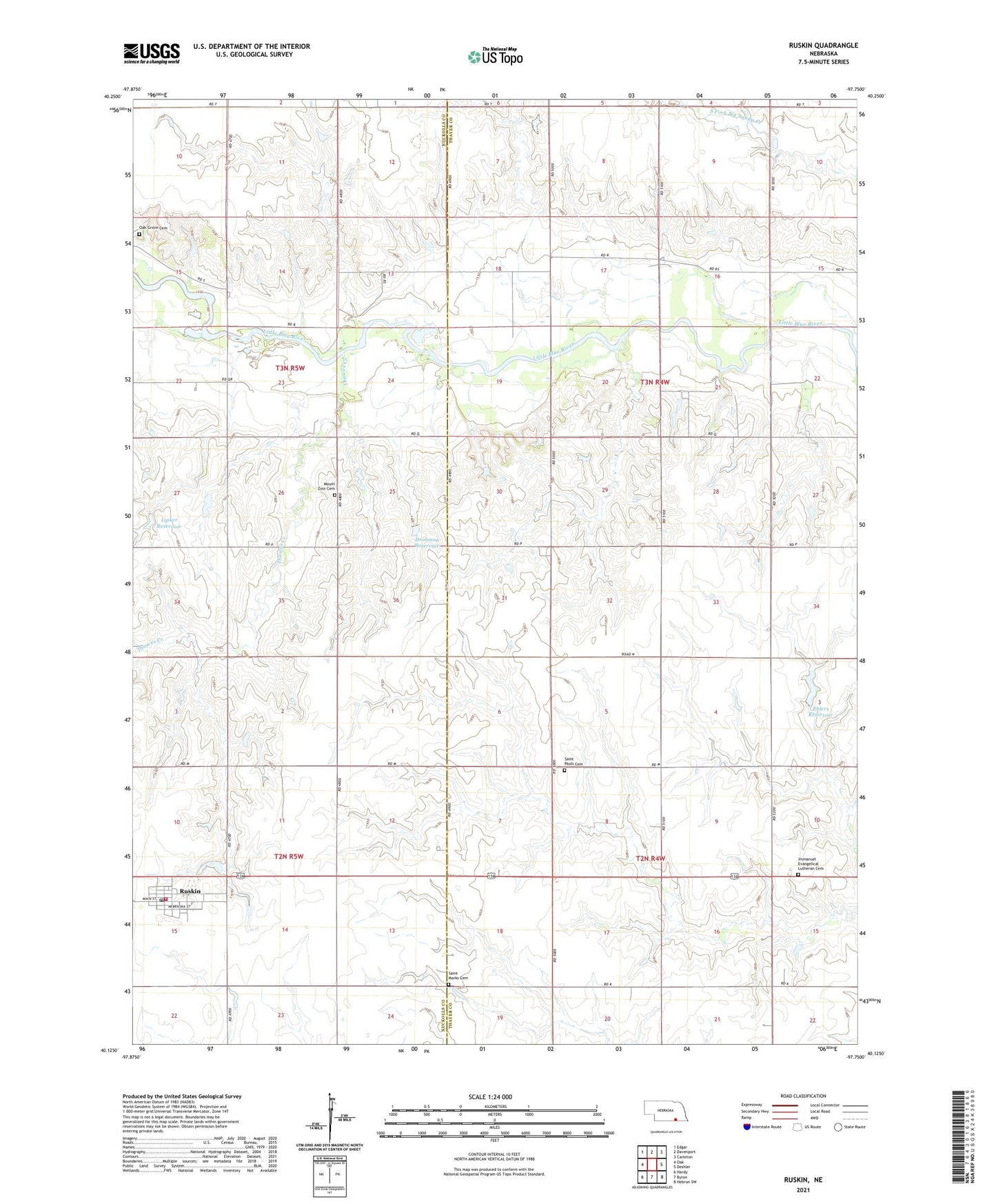
2021 topographic map quadrangle Ruskin in the state of Nebraska. Scale: 1:24000. Based on the newly updated USGS 7.5' US Topo map series, this map is in the following counties: Thayer, Nuckolls. The map contains contour data, water features, and other items you are used to seeing on USGS maps, but also has updated roads and other features. This is the next generation of topographic maps. Printed on high-quality waterproof paper with UV fade-resistant inks.
Quads adjacent to this one:
West: Oak
Northwest: Edgar
North: Davenport
Northeast: Carleton
East: Deshler
Southeast: Hebron SW
South: Byron
Southwest: Hardy
This map covers the same area as the classic USGS quad with code o40097b7.
Contains the following named places: Bethlehem Lutheran Parochial School, Drohman Dam, Drohman Reservoir, Ehlers Dam, Ehlers Reservoir, Farmers Union Cooperative Association Elevator, Immanuel Evangelical Lutheran Cemetery, Immanuel Lutheran Parochial School, Kiowa School, Lipker Dam, Lipker Reservoir, Mount Zion Cemetery, Oak Grove Cemetery, Ruskin, Ruskin Ball Field and Park, Ruskin Post Office, Ruskin Public Library, Ruskin Volunteer Fire Department, Saint Marks Cemetery, Saint Marks Lutheran Church, Saint Marks Lutheran Parochial School, Saint Pauls Cemetery, Sunshine Valley School, Thawes Creek, Township of Kiowa, Turtle Creek, Village of Ruskin, ZIP Codes: 68340, 68974