MyTopo
Emerick Nebraska US Topo Map
Couldn't load pickup availability
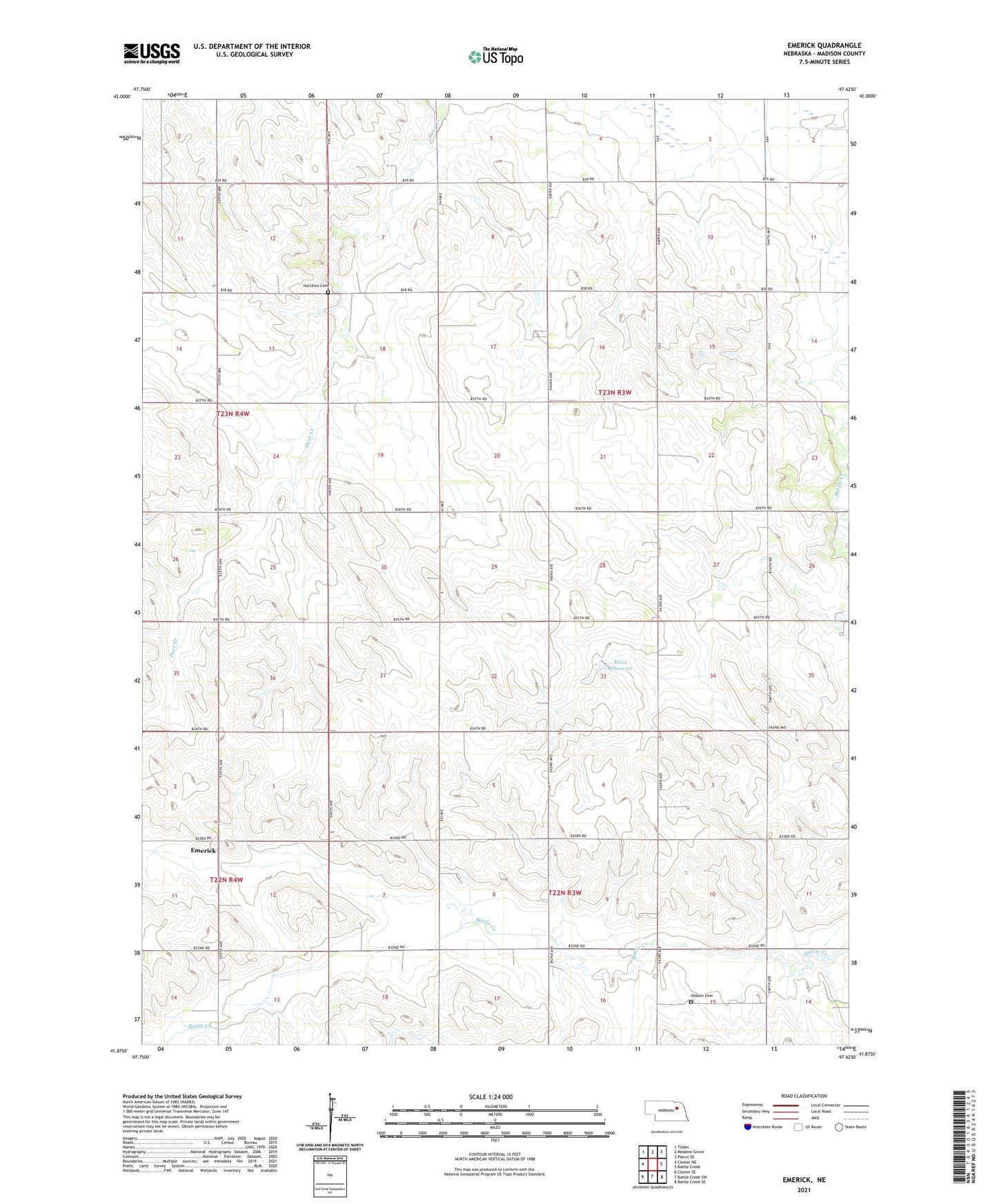
2021 topographic map quadrangle Emerick in the state of Nebraska. Scale: 1:24000. Based on the newly updated USGS 7.5' US Topo map series, this map is in the following counties: Madison. The map contains contour data, water features, and other items you are used to seeing on USGS maps, but also has updated roads and other features. This is the next generation of topographic maps. Printed on high-quality waterproof paper with UV fade-resistant inks.
Quads adjacent to this one:
West: Closter NE
Northwest: Tilden
North: Meadow Grove
Northeast: Pierce SE
East: Battle Creek
Southeast: Battle Creek SE
South: Battle Creek SW
Southwest: Closter SE
Contains the following named places: Blakeley School, Brookside School, Deer Creek School, East Emerick School, Emerick, Emerick Post Office, Emerick Public School, Highland Election Precinct, Highland View School, Hillside School, Hutchins Cemetery, KEXL-FM (Norfolk), Klein Dam, Klein Reservoir, Mount Hope School, Osborn Cemetery, Whitehouse School