MyTopo
Closter SE Nebraska US Topo Map
Couldn't load pickup availability
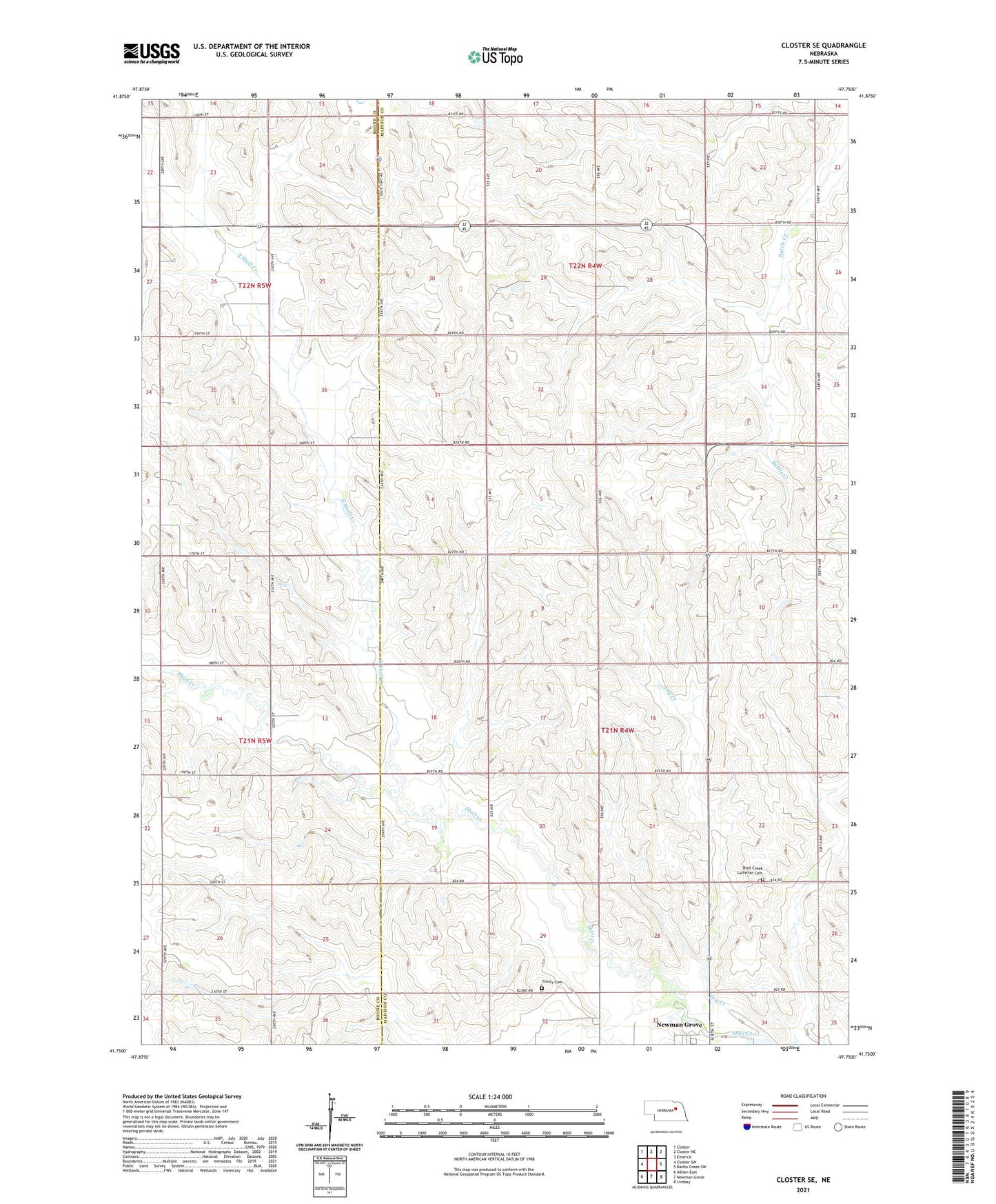
2021 topographic map quadrangle Closter SE in the state of Nebraska. Scale: 1:24000. Based on the newly updated USGS 7.5' US Topo map series, this map is in the following counties: Madison, Boone. The map contains contour data, water features, and other items you are used to seeing on USGS maps, but also has updated roads and other features. This is the next generation of topographic maps. Printed on high-quality waterproof paper with UV fade-resistant inks.
Quads adjacent to this one:
West: Closter SW
Northwest: Closter
North: Closter NE
Northeast: Emerick
East: Battle Creek SW
Southeast: Lindsay
South: Newman Grove
Southwest: Albion East
This map covers the same area as the classic USGS quad with code o41097g7.
Contains the following named places: Cloverleaf Public School, Dry Creek, Emerick Election Precinct, Newman Grove, Newman Grove City Park, Newman Grove City Park Campground, Newman Grove Golf Club, North Shell Creek, Rose Hill Church, Saint Pauls Church, School Number 29, School Number 38, School Number 54, School Number 58, School Number 62, School Number 67, School Number 68, Shell Creek Election Precinct, Shell Creek Lutheran Cemetery, Shell Creek Public School, Trinity Cemetery, ZIP Code: 68758