MyTopo
Meadow Grove Nebraska US Topo Map
Couldn't load pickup availability
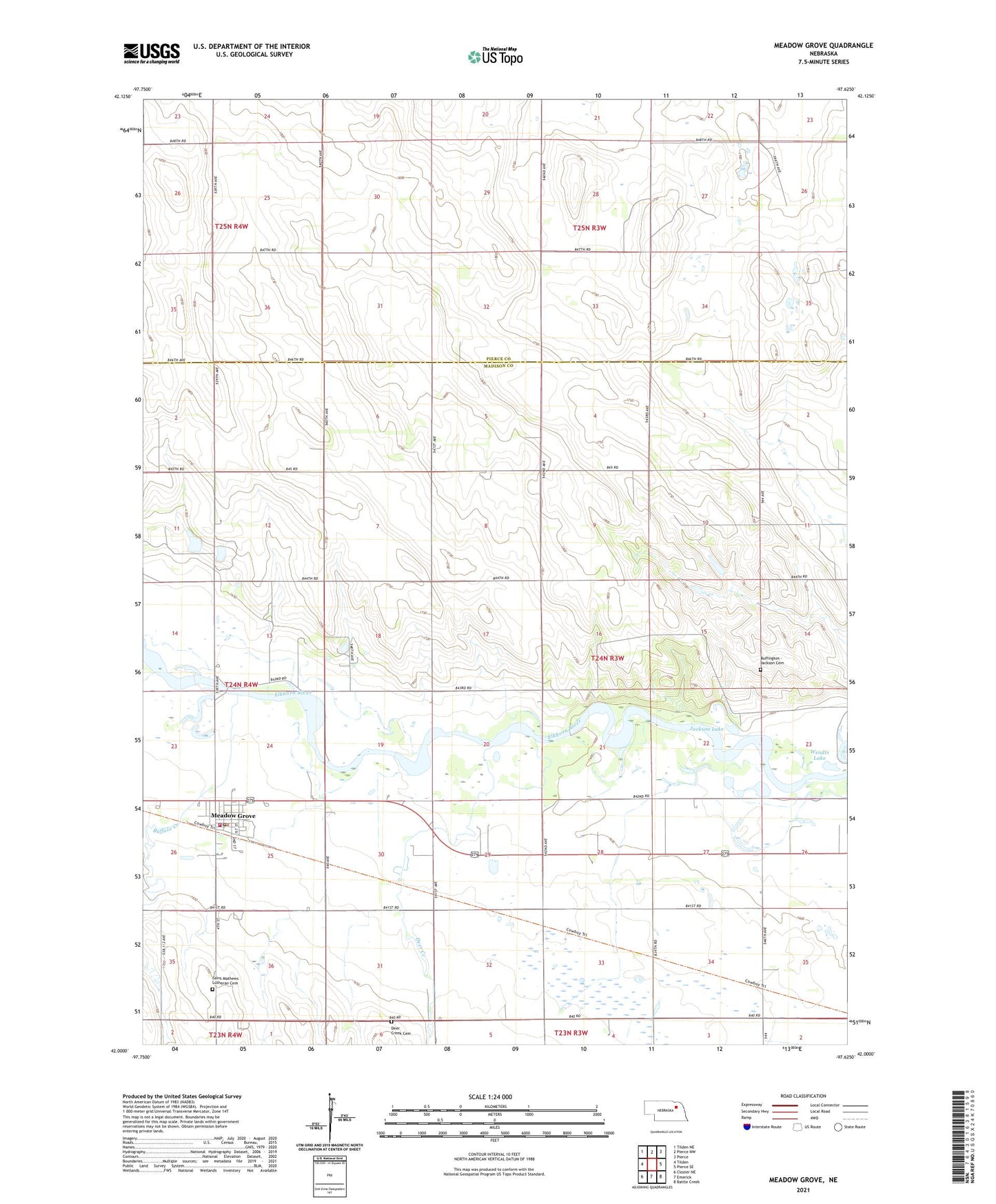
2021 topographic map quadrangle Meadow Grove in the state of Nebraska. Scale: 1:24000. Based on the newly updated USGS 7.5' US Topo map series, this map is in the following counties: Madison, Pierce. The map contains contour data, water features, and other items you are used to seeing on USGS maps, but also has updated roads and other features. This is the next generation of topographic maps. Printed on high-quality waterproof paper with UV fade-resistant inks.
Quads adjacent to this one:
West: Tilden
Northwest: Tilden NE
North: Pierce NW
Northeast: Pierce
East: Pierce SE
Southeast: Battle Creek
South: Emerick
Southwest: Closter NE
This map covers the same area as the classic USGS quad with code o42097a6.
Contains the following named places: Buffalo Creek, Buffington - Jackson Cemetery, Deer Creek, Deer Creek Cemetery, Hughes School, Jackson Lake, Meadow Grove, Meadow Grove Historical Marker, Meadow Grove Museum, Meadow Grove Police Department, Meadow Grove Post Office, Meadow Grove Public Library, Meadow Grove Volunteer Fire Department, Meadow Grove-Jefferson Election Precinct, Pleasant Hill School, Saint Mathews Lutheran Cemetery, Saint Matthews Lutheran Church, School Number 24, Sullivan School, Township of Grove, Township of Highland, Township of Meadow Grove, Township of North Deer Creek, Township of South Deer Creek, United Methodist Church, Village of Meadow Grove, Wayside Park, Wayside Park Campground, Wendts Lake, Yellowbanks State Wildlife Management Area, ZIP Code: 68752