MyTopo
Endicott Nebraska US Topo Map
Couldn't load pickup availability
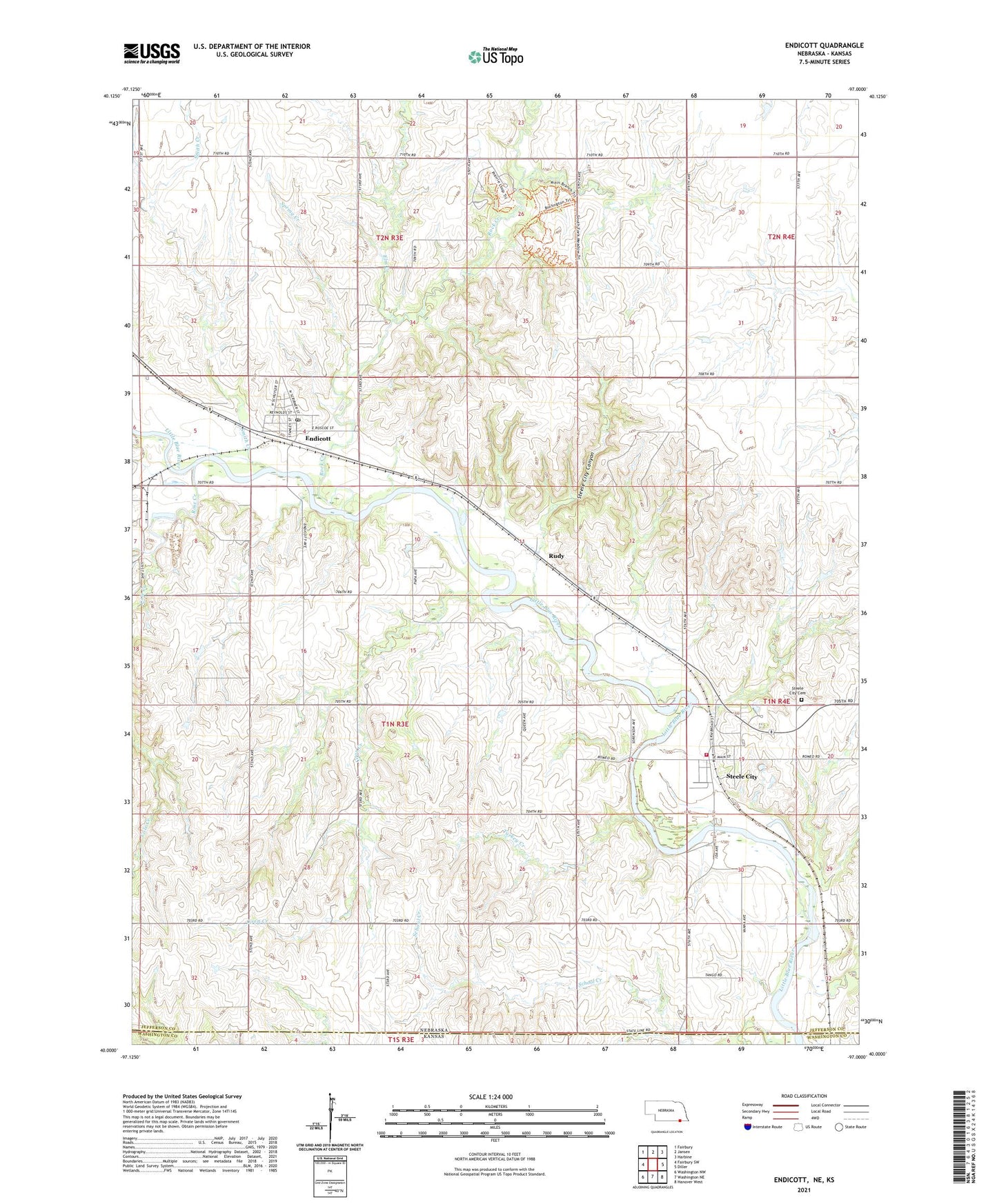
2021 topographic map quadrangle Endicott in the states of Nebraska, Kansas. Scale: 1:24000. Based on the newly updated USGS 7.5' US Topo map series, this map is in the following counties: Jefferson, Washington. The map contains contour data, water features, and other items you are used to seeing on USGS maps, but also has updated roads and other features. This is the next generation of topographic maps. Printed on high-quality waterproof paper with UV fade-resistant inks.
Quads adjacent to this one:
West: Fairbury SW
Northwest: Fairbury
North: Jansen
Northeast: Harbine
East: Diller
Southeast: Hanover West
South: Washington NE
Southwest: Washington NW
Contains the following named places: Cole Creek, Coon Creek, Elm Creek, Endicott, Endicott Election Precinct, Endicott Post Office, Presbyterian Church, Rock Creek, Rock Creek Station State Historical Park, Rock Creek Station State Recreation Area, Rock Creek Station Trails, Rock Glen State Wildlife Mangement Area, Rose Creek, Rose Creek State Wildlife Management Area, Rudy, School Creek, Shea, Shea Post Office, Smith Creek, Spring Creek, Steele City, Steele City Canyon, Steele City Cemetery, Steele City Post Office, Steele City Rural Volunteer Fire and Rescue, Township of Endicott, Turkey Creek, United Methodist Church, Village of Endicott, Village of Steele City, ZIP Codes: 68350, 68440