MyTopo
Fairbury Nebraska US Topo Map
Couldn't load pickup availability
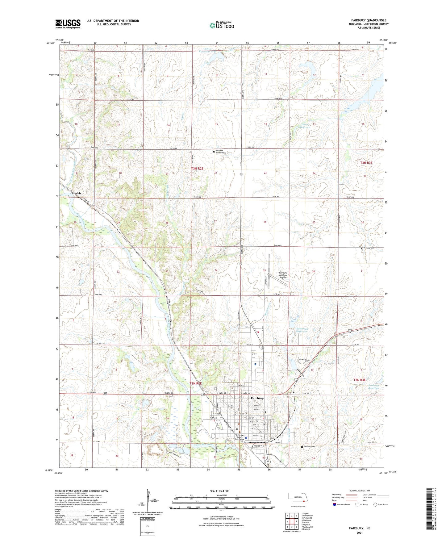
2021 topographic map quadrangle Fairbury in the state of Nebraska. Scale: 1:24000. Based on the newly updated USGS 7.5' US Topo map series, this map is in the following counties: Jefferson. The map contains contour data, water features, and other items you are used to seeing on USGS maps, but also has updated roads and other features. This is the next generation of topographic maps. Printed on high-quality waterproof paper with UV fade-resistant inks.
Quads adjacent to this one:
West: Gladstone
Northwest: Daykin
North: Western SW
Northeast: Western SE
East: Jansen
Southeast: Endicott
South: Fairbury SW
Southwest: Reynolds
This map covers the same area as the classic USGS quad with code o40097b2.
Contains the following named places: Behavioral Medicine Clinic, Central Elementary School, City of Fairbury, Crystal Springs Campground, Crystal Springs Park, Cub Creek Dam 17-B, Cub Creek Reservoir 14-A, Cub Creek Reservoir 16-B, Cub Creek Reservoir 17-B, Davis Dam, Davis Reservoir, East Ward School, Eye Surgical Associates, Fairbury, Fairbury Cemetery, Fairbury City Fire Department, Fairbury City Museum, Fairbury Clinic, Fairbury Dental Associates Center, Fairbury Election Precinct, Fairbury Junior-Senior High School, Fairbury Municipal Airport, Fairbury Post Office, Fairbury Presbyterian Church, Fairbury Public Library, Fairbury Rural Fire Department, Faith Lutheran Church, Farmers Co-operative Elevator, First Baptist Church, First Church of God, Floodwater Retarding Dam 16-B, Frederick Dam, Frederick Reservoir, Gardener School, Glaeseman Reservoir, Grace Lutheran Church, Grandy Cemetery, Happy Hollow School, Harvest Outreach Church, Hedrix, Heritage Care Center, Jefferson Community Health Care System, Jefferson County, Jefferson County Ambulance, Jefferson County Courthouse, Jefferson County Fairground, Jefferson County Historical Museum, Jefferson County Memorial Hospital Heliport, Jefferson County Sheriff's Office, Jefferson Intermediate School, Johnson Family Vision Care, Kingdom Hall of Jehovahs Witnesses, Little Sandy Creek, Maple Grove School, McNush Park, Park School, Richland Center Cemetery, Richland Center School, Richland Election Precinct, Rock Island Depot Railroad Museum, Rudolph E Glaeseman Detention Dam, Saint Charles Episcopal Church, Saint Michael Catholic Church, Saint Michaels School, Seventh Day Adventist Church, Smith Limekiln Historical Marker, Stagecoach Mall, The Church of Jesus Christ of Latter Day Saints, Township of Fairbury, Township of Richland, Traums School, United Methodist Church, West Ward School, Whisky Run, ZIP Code: 68352