MyTopo
Fairbury SW Nebraska US Topo Map
Couldn't load pickup availability
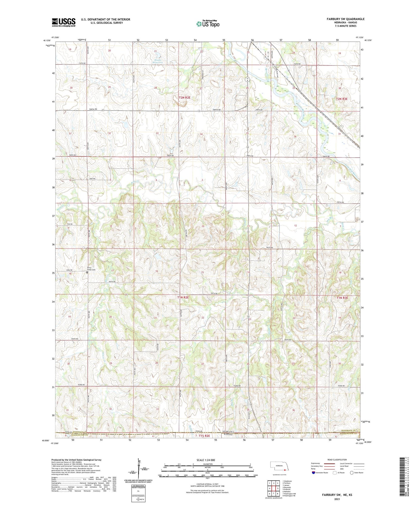
2021 topographic map quadrangle Fairbury SW in the state of Nebraska. Scale: 1:24000. Based on the newly updated USGS 7.5' US Topo map series, this map is in the following counties: Jefferson, Washington. The map contains contour data, water features, and other items you are used to seeing on USGS maps, but also has updated roads and other features. This is the next generation of topographic maps. Printed on high-quality waterproof paper with UV fade-resistant inks.
Quads adjacent to this one:
West: Reynolds
Northwest: Gladstone
North: Fairbury
Northeast: Jansen
East: Endicott
Southeast: Washington NE
South: Washington NW
Southwest: Mahaska
Contains the following named places: Antelope Election Precinct, Brawner Creek, Dry Branch, Dry Branch School, Fairbury Country Club, Haake Dam, Haake Reservoir, Kesterson School, KGMT-AM (Fairbury), Pleasant Valley School, School Number 89, Silver Creek, Silver Creek Cemetery, Township of Antelope