MyTopo
Falls City Nebraska US Topo Map
Couldn't load pickup availability
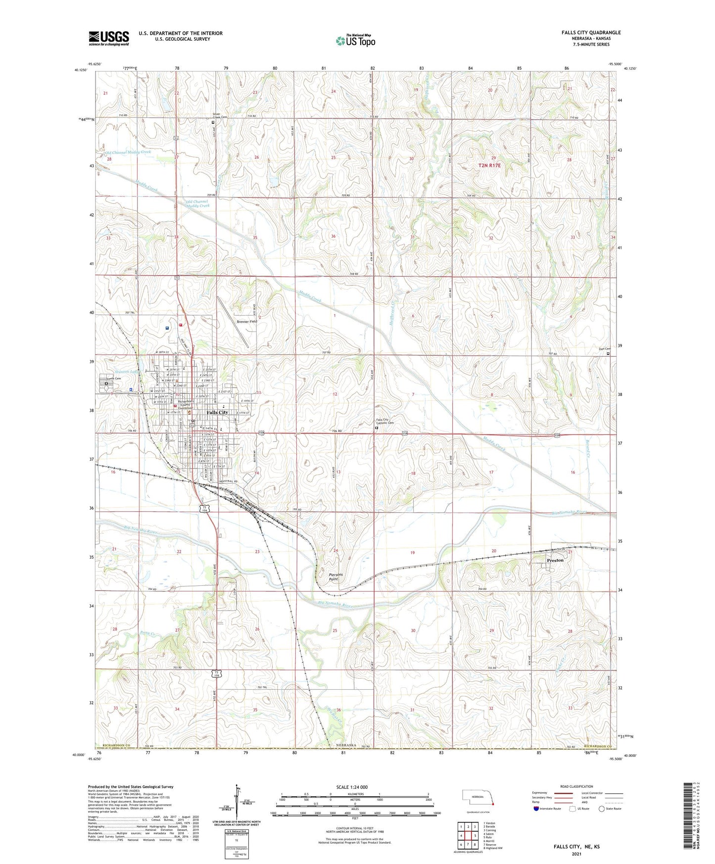
2021 topographic map quadrangle Falls City in the state of Nebraska. Scale: 1:24000. Based on the newly updated USGS 7.5' US Topo map series, this map is in the following counties: Richardson, Brown. The map contains contour data, water features, and other items you are used to seeing on USGS maps, but also has updated roads and other features. This is the next generation of topographic maps. Printed on high-quality waterproof paper with UV fade-resistant inks.
Quads adjacent to this one:
West: Salem
Northwest: Verdon
North: Barada
Northeast: Corning
East: Rulo
Southeast: Highland NW
South: Reserve
Southwest: Morrill
Contains the following named places: Archer, Archer Post Office, Berard Creek, Bethel United Methodist Church, Brenner Field, Christ Lutheran Church, Church of Christ, Church of the Nazarene, City of Falls City, Community Medical Center, Counsellor School, Crystal Beach Dam, Crystal Beach Reservoir, Dallas Jones Memorial Park, Faith Baptist Church, Falls City, Falls City Care Center, Falls City Catholic Cemetery, Falls City Election Precinct, Falls City Family Practice, Falls City First Baptist Church, Falls City Grain Company Elevator, Falls City Middle School, Falls City North Elementary School, Falls City Police Department, Falls City Post Office, Falls City Rural Fire Department, Falls City Senior High School, Falls City South Elementary School, Falls City Volunteer Ambulance Squad, Falls City Volunteer Fire Department, Family Dental Center, Family Medicine, First Brethren Church, First Christian Church, First Presbyterian Church, First United Methodist Church, Good News Assembly of God Church, Grandview Park, Halfbreed Creek, Immanuel United Methodist Church, Itha-Krumme Memorial Arboretum, Jefferson Election Precinct, John Falter Memorial Park, Jug Brown Stadium, Kingdom Hall of Jehovahs Witnesses, KTNC-AM (Falls City), Legion Park, Lydia Bruun Woods Memorial Library, Midland Villa Nursing Home, Midlands Dental Center, Muddy Creek, Nemaha Falls Post Office, Old Channel Muddy Creek, Parkside Dental Clinic, Piersons Point, Pioneer Park, Pleasant View School, Pony Creek, Preston, Preston Post Office, Richardson County Courthouse, Richardson County Historical Society Museum, Richardson County Military History Museum, Richardson County Sheriff's Office, Sac and Fox Nation Reservation, Sacred Heart School, Saint Pauls Lutheran Church, Saint Thomas Episcopal Church, Saints Peter and Paul Catholic Church, Seventh Day Adventist Church, Silver Creek, Silver Creek Cemetery, Stanton Lake, Stanton Lake Campground, Stanton Lake Park, Steele Cemetery, Stephenson Motel and Trailer Park, Sunny Hill School, Village of Preston, Walnut Creek, Water Tower Mini Park, Zion Cemetery, ZIP Code: 68355