MyTopo
Reserve Kansas US Topo Map
Couldn't load pickup availability
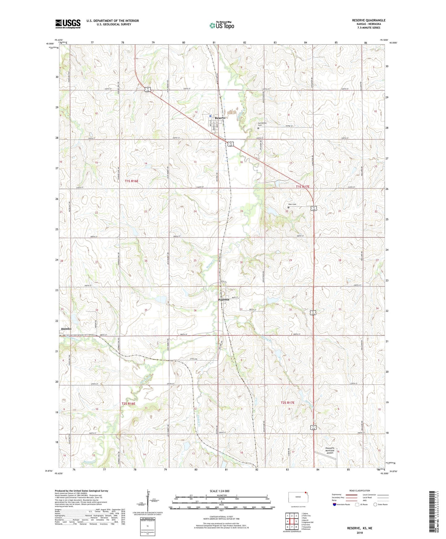
2022 topographic map quadrangle Reserve in the state of Kansas. Scale: 1:24000. Based on the newly updated USGS 7.5' US Topo map series, this map is in the following counties: Brown, Richardson. The map contains contour data, water features, and other items you are used to seeing on USGS maps, but also has updated roads and other features. This is the next generation of topographic maps. Printed on high-quality waterproof paper with UV fade-resistant inks.
Quads adjacent to this one:
West: Morrill
Northwest: Salem
North: Falls City
Northeast: Rulo
East: Highland NW
Southeast: Robinson
South: Hiawatha
Southwest: Fairview
This map covers the same area as the classic USGS quad with code o39095h5.
Contains the following named places: Agricultural Partners Co - Operative Grain Elevator Number 4, Agricultural Partners Co - Operative Grain Elevator Number 6, City of Reserve, Cornelison Cemetery, Euchre Creek, Hart Cemetery, Hart School, Hiawatha Mennonite Church, Hiawatha Municipal Airport, Padonia, Reserve, Reserve Elementary School, Sac and Fox Tribal Police Department, Spring Branch, Terrapin Creek, Township of Hamlin, Township of Padonia, Victory School