MyTopo
Five Points Nebraska US Topo Map
Couldn't load pickup availability
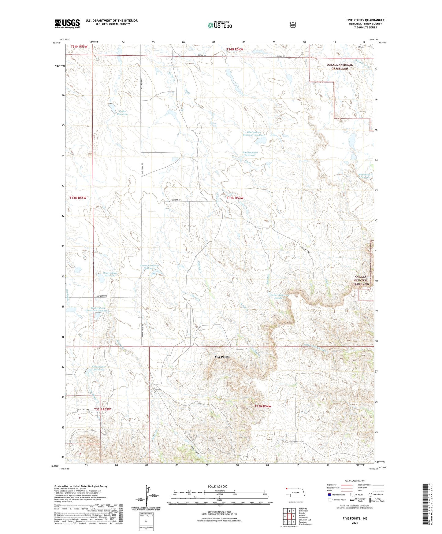
2021 topographic map quadrangle Five Points in the state of Nebraska. Scale: 1:24000. Based on the newly updated USGS 7.5' US Topo map series, this map is in the following counties: Sioux. The map contains contour data, water features, and other items you are used to seeing on USGS maps, but also has updated roads and other features. This is the next generation of topographic maps. Printed on high-quality waterproof paper with UV fade-resistant inks.
Quads adjacent to this one:
West: Bodarc
Northwest: Story NE
North: Montrose
Northeast: Orella
East: Roundtop
Southeast: Smiley Canyon
South: Andrews
Southwest: Harrison East
Contains the following named places: Beans Canyon, Cherry Creek, Coffee Dam, Coffee Dam Number 1, Coffee Reservoir, Coffee Reservoir Number 1, Cowboy Creek, Eberspecher Dam, Eberspecher Dam Number 1, Eberspecher Reservoir, Eberspecher Reservoir Number 1, Five Points, Licket Creek, Licket Ranch, Piper Ranch, Serres Dam Number 2, Serres Reservoir Number 2, Staudenmaier Dam, Staudenmaier Reservoir, West Jim Creek, Whitehead Dam, Whitehead Reservoir, Wickersham Dam, Wickersham Dam Number 2, Wickersham Reservoir, Wickersham Reservoir Number 2