MyTopo
Roundtop Nebraska US Topo Map
Couldn't load pickup availability
Also explore the Roundtop Forest Service Topo of this same quad for updated USFS data
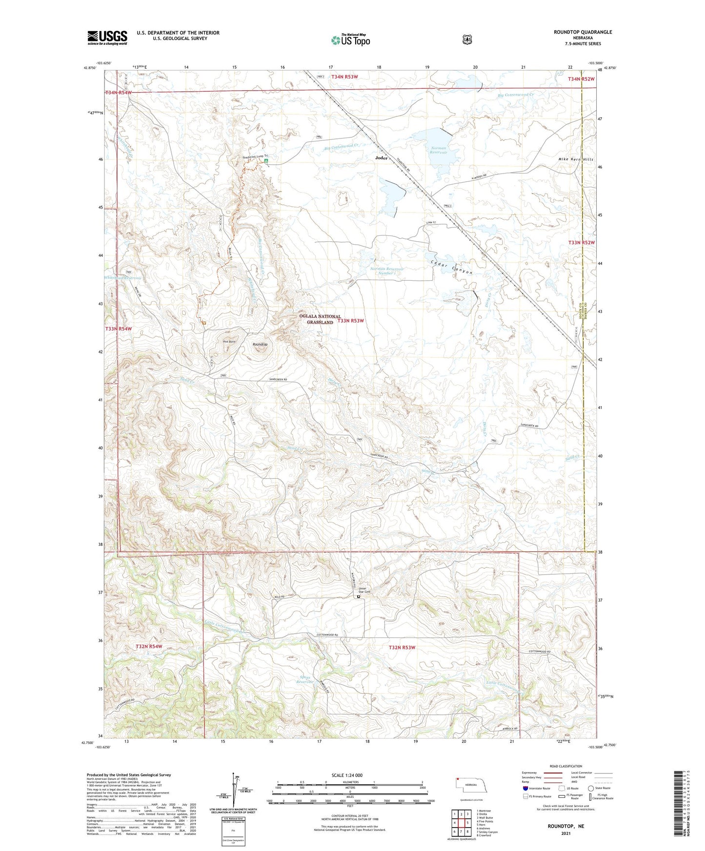
2021 topographic map quadrangle Roundtop in the state of Nebraska. Scale: 1:24000. Based on the newly updated USGS 7.5' US Topo map series, this map is in the following counties: Sioux, Dawes. The map contains contour data, water features, and other items you are used to seeing on USGS maps, but also has updated roads and other features. This is the next generation of topographic maps. Printed on high-quality waterproof paper with UV fade-resistant inks.
Quads adjacent to this one:
West: Five Points
Northwest: Montrose
North: Orella
Northeast: Wolf Butte
East: Horn
Southeast: Crawford
South: Smiley Canyon
Southwest: Andrews
This map covers the same area as the classic USGS quad with code o42103g5.
Contains the following named places: Carbody Dam, Carbody Reservoir, Cedar Canyon, Eagles Eye, Hudson-Meng Bison Kill Site, Joder, Little Cottonwood School, Meng Ranch, Norman Dam Number 1, Norman Dam Number 2, Norman Dam Number 3, Norman Reservoir, Norman Reservoir Number 1, Norman Reservoir Number 3, Norman School, Pine Butte, Roundtop, Roundtop School, Speas Dam, Speas Reservoir, Toadstool Campground, Toadstool Park, Toadstool Trail, Union Star Cemetery