MyTopo
Friend SW Nebraska US Topo Map
Couldn't load pickup availability
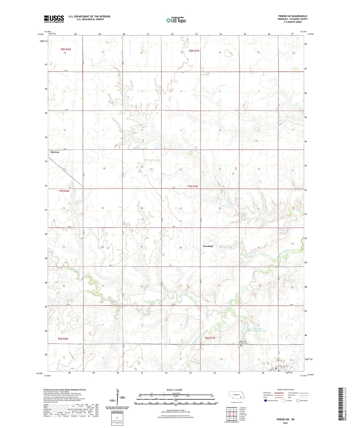
2021 topographic map quadrangle Friend SW in the state of Nebraska. Scale: 1:24000. Based on the newly updated USGS 7.5' US Topo map series, this map is in the following counties: Fillmore. The map contains contour data, water features, and other items you are used to seeing on USGS maps, but also has updated roads and other features. This is the next generation of topographic maps. Printed on high-quality waterproof paper with UV fade-resistant inks.
Quads adjacent to this one:
West: Geneva
Northwest: Fairmont
North: Exeter
Northeast: Friend
East: Friend SE
Southeast: Tobias
South: Ohiowa
Southwest: Strang
Contains the following named places: Blizzard of 1888 Historical Marker, Bohemian Brethren Cemetery, Cedar View Recreation Reservoir, Dorchester Farmers Cooperative - Milligan Elevator, Kassik Milling Company Incorporated Elevator, Kubicek Dam, Milligan, Milligan Post Office, Milligan Public Library, Milligan Public Schools, Milligan Volunteer Fire and Rescue Department, Saint Wenceslaus Catholic Church, South Fork Turkey Creek, Townhall, Township of Liberty, Village of Milligan, ZIP Code: 68406