MyTopo
Exeter Nebraska US Topo Map
Couldn't load pickup availability
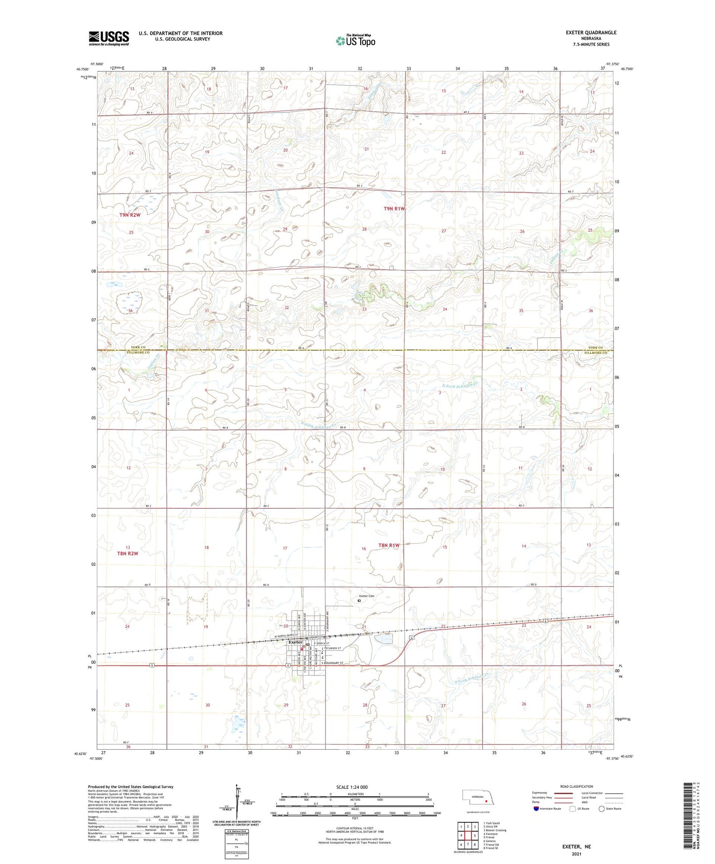
2021 topographic map quadrangle Exeter in the state of Nebraska. Scale: 1:24000. Based on the newly updated USGS 7.5' US Topo map series, this map is in the following counties: Fillmore, York. The map contains contour data, water features, and other items you are used to seeing on USGS maps, but also has updated roads and other features. This is the next generation of topographic maps. Printed on high-quality waterproof paper with UV fade-resistant inks.
Quads adjacent to this one:
West: Fairmont
Northwest: York South
North: Utica SW
Northeast: Beaver Crossing
East: Friend
Southeast: Friend SE
South: Friend SW
Southwest: Geneva
This map covers the same area as the classic USGS quad with code o40097f4.
Contains the following named places: Community Care of Exeter, Dorchester Farmers Cooperative - Exeter Elevator, Exeter, Exeter Cemetery, Exeter Historical Marker, Exeter Medical Clinic, Exeter Police Department, Exeter Post Office, Exeter Public Library, Exeter Public Schools, Exeter Volunteer Fire Department and Rescue, Hidden Marsh State Wildlife Management Area, Horne Chiropractic Clinic, Methodist Church, Saint Stephen Catholic Church, Township of Exeter, Township of Exeter-Fairmont Consolidated, Township of West Blue, Village of Exeter, West Blue Election Precinct, ZIP Code: 68351