MyTopo
Fairmont Nebraska US Topo Map
Couldn't load pickup availability
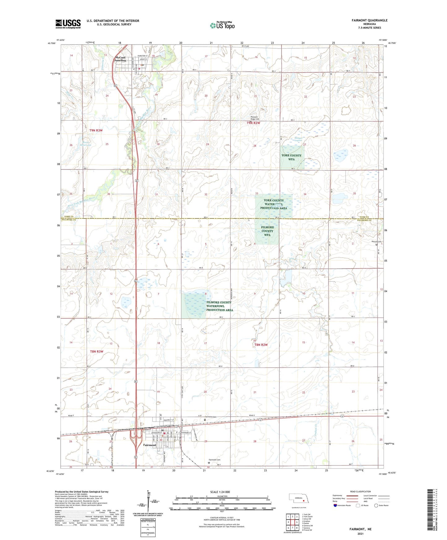
2021 topographic map quadrangle Fairmont in the state of Nebraska. Scale: 1:24000. Based on the newly updated USGS 7.5' US Topo map series, this map is in the following counties: Fillmore, York. The map contains contour data, water features, and other items you are used to seeing on USGS maps, but also has updated roads and other features. This is the next generation of topographic maps. Printed on high-quality waterproof paper with UV fade-resistant inks.
Quads adjacent to this one:
West: Grafton
Northwest: York SW
North: York South
Northeast: Utica SW
East: Exeter
Southeast: Friend SW
South: Geneva
Southwest: Geneva SW
This map covers the same area as the classic USGS quad with code o40097f5.
Contains the following named places: County Line Federal Waterfowl Production Area, County Line Marsh, Crosstrails Wayside Park, Dorchester Farmers Co-op Association Elevator, Fairmont, Fairmont Army Air Field Historical Marker, Fairmont Cemetery, Fairmont Creamery Company Historical Marker, Fairmont Post Office, Fairmont Public Library, Fairmont Public Schools, Fairmont Volunteer Fire Department, Fairview Manor, Farmers Co-op Elevator, Fillmore County Museum, First Evangelical Lutheran Church, Galaway Creek, H and D Campground, Horton Cemetery, Manning Grain Company Elevator, McCool Junction, McCool Junction Post Office, McCool Junction Public Schools, McCool Junction Rural Fire District, McFadden Election Precinct, Pleasant Ridge Cemetery, Real Federal Waterfowl Production Area, Saint Patrick Catholic Church, Sininger Lagoon, Sinninger Federal Waterfowl Production Area, Stone Creek, Township of Fairmont, Township of McFadden, United Methodist Church, Village of Fairmont, Village of McCool Junction, Weiss Reservoir, Weiss Road Dam, ZIP Codes: 68354, 68401