MyTopo
Friend Nebraska US Topo Map
Couldn't load pickup availability
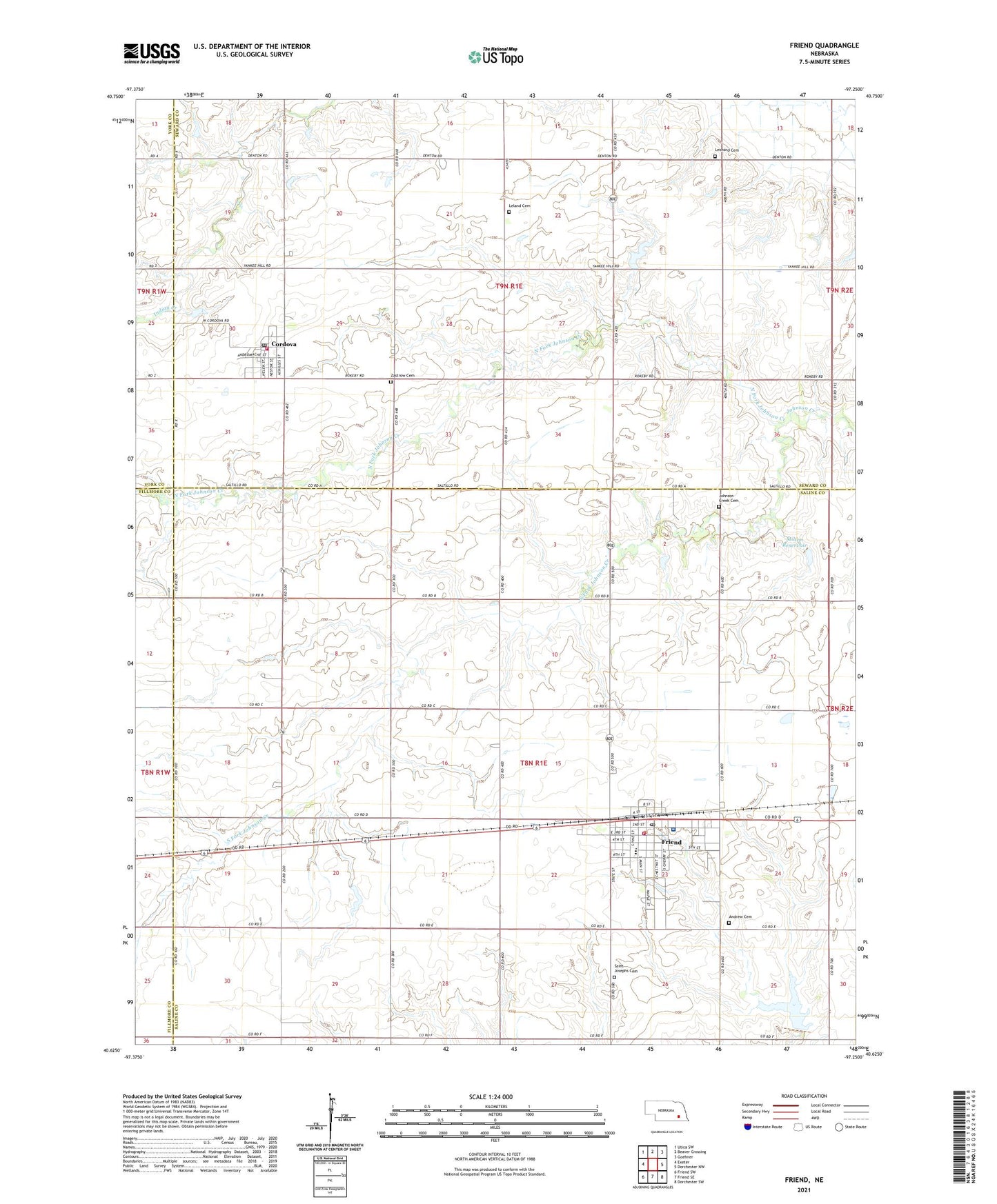
2021 topographic map quadrangle Friend in the state of Nebraska. Scale: 1:24000. Based on the newly updated USGS 7.5' US Topo map series, this map is in the following counties: Saline, Seward, Fillmore, York. The map contains contour data, water features, and other items you are used to seeing on USGS maps, but also has updated roads and other features. This is the next generation of topographic maps. Printed on high-quality waterproof paper with UV fade-resistant inks.
Quads adjacent to this one:
West: Exeter
Northwest: Utica SW
North: Beaver Crossing
Northeast: Goehner
East: Dorchester NW
Southeast: Dorchester SW
South: Friend SE
Southwest: Friend SW
This map covers the same area as the classic USGS quad with code o40097f3.
Contains the following named places: Andrew Cemetery, Burley Park, City of Friend, Cordova, Cordova Post Office, Cordova Volunteer Fire Department, Dorchester Farmers Co-op Elevator, Election Precinct M, Farmers Union Cooperative Company Elevator, Friend, Friend Berean Church, Friend Christian Assembly, Friend Country Club, Friend Election Precinct, Friend Medical Center, Friend Park, Friend Police Department, Friend Post Office, Friend Public Schools, Friend Volunteer Fire Department, Gilbert Public Library, Johnson Creek Cemetery, Leland Cemetery, Leonard Cemetery, Milton Dam, Milton Reservoir, North Fork Johnson Creek, Potter-Reich Dam, Potter-Reich Reservoir, Precinct M Cordova Election Precinct, Saint Johns Lutheran Church, Saint Josephs Catholic Church, Saint Josephs Cemetery, South Fork Johnson Creek, Township M, Township of Friend, United Church of Christ, United Methodist Church, Village of Cordova, Warren Memorial Hospital, Zastrow Cemetery, ZIP Code: 68359