MyTopo
Gothenburg SE Nebraska US Topo Map
Couldn't load pickup availability
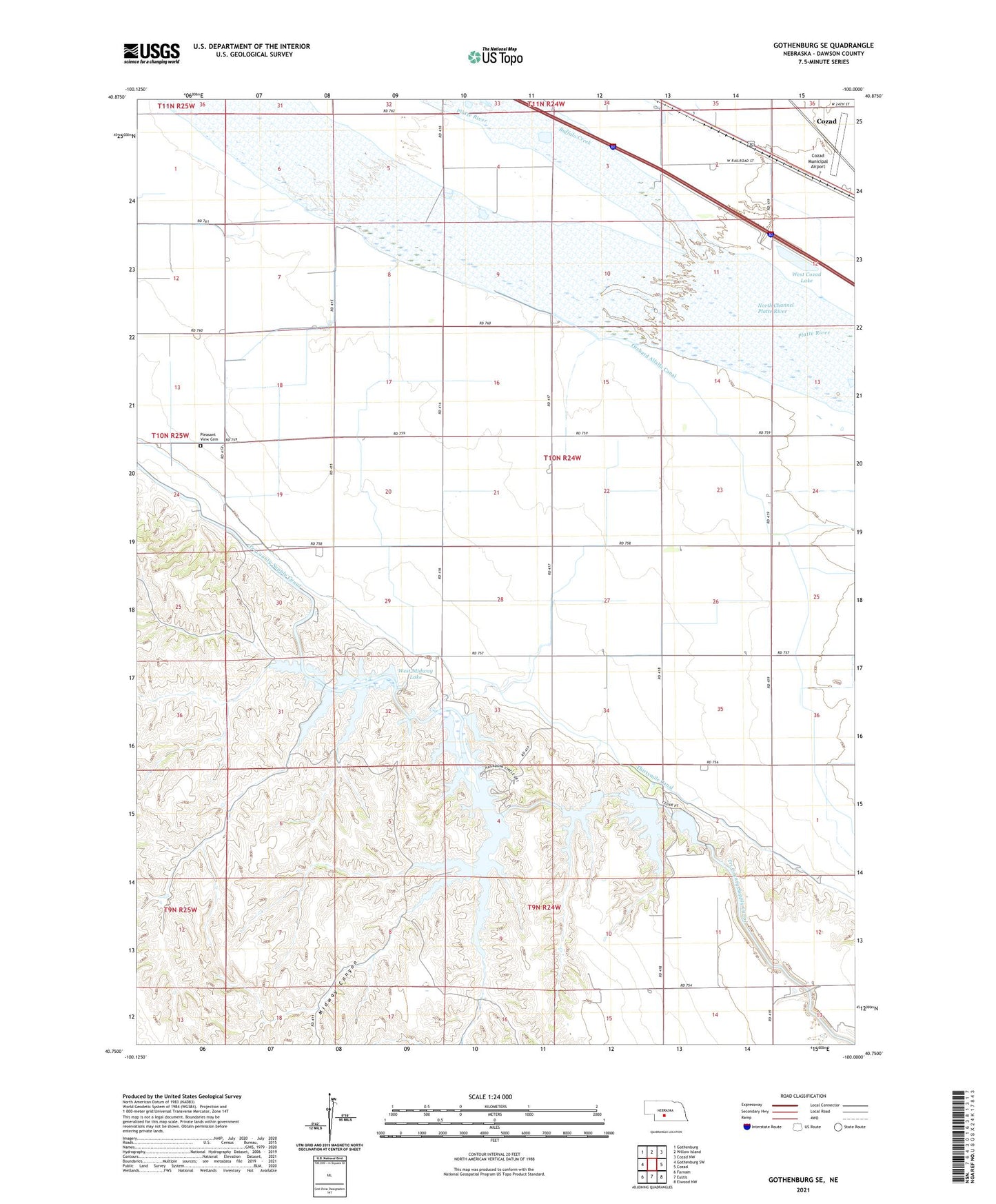
2021 topographic map quadrangle Gothenburg SE in the state of Nebraska. Scale: 1:24000. Based on the newly updated USGS 7.5' US Topo map series, this map is in the following counties: Dawson. The map contains contour data, water features, and other items you are used to seeing on USGS maps, but also has updated roads and other features. This is the next generation of topographic maps. Printed on high-quality waterproof paper with UV fade-resistant inks.
Quads adjacent to this one:
West: Gothenburg SW
Northwest: Gothenburg
North: Willow Island
Northeast: Cozad NW
East: Cozad
Southeast: Elwood NW
South: Eustis
Southwest: Farnam
Contains the following named places: Buffalo Creek, Camp Comeca, Central Midway Lake, Cozad Municipal Airport, Earth Dam-Canal Mile 461 Dam, Earth Dam-Canal Mile 475 Dam, Earth Dam-Canal Mile 479 Dam, Earth Dam-Canal Mile 483 Dam, Earth Dam-Canal Mile 505 Dam, Earth Dam-Canal Mile 51 Dam, Earth Dam-Canal Mile 515 Dam, Earth Dam-Canal Mile 52 Dam, East Midway Lake, East Willow Island State Wildlife Management Area, KAMI-FM (Cozad), Midway Canyon, Midway Lake Recreational Grounds, Orchard Alfalfa Canal, Pleasant View Cemetery, Township of Fairview, West Cozad Lake, West Cozad State Wildlife Management Area, West Midway Lake