MyTopo
Cozad Nebraska US Topo Map
Couldn't load pickup availability
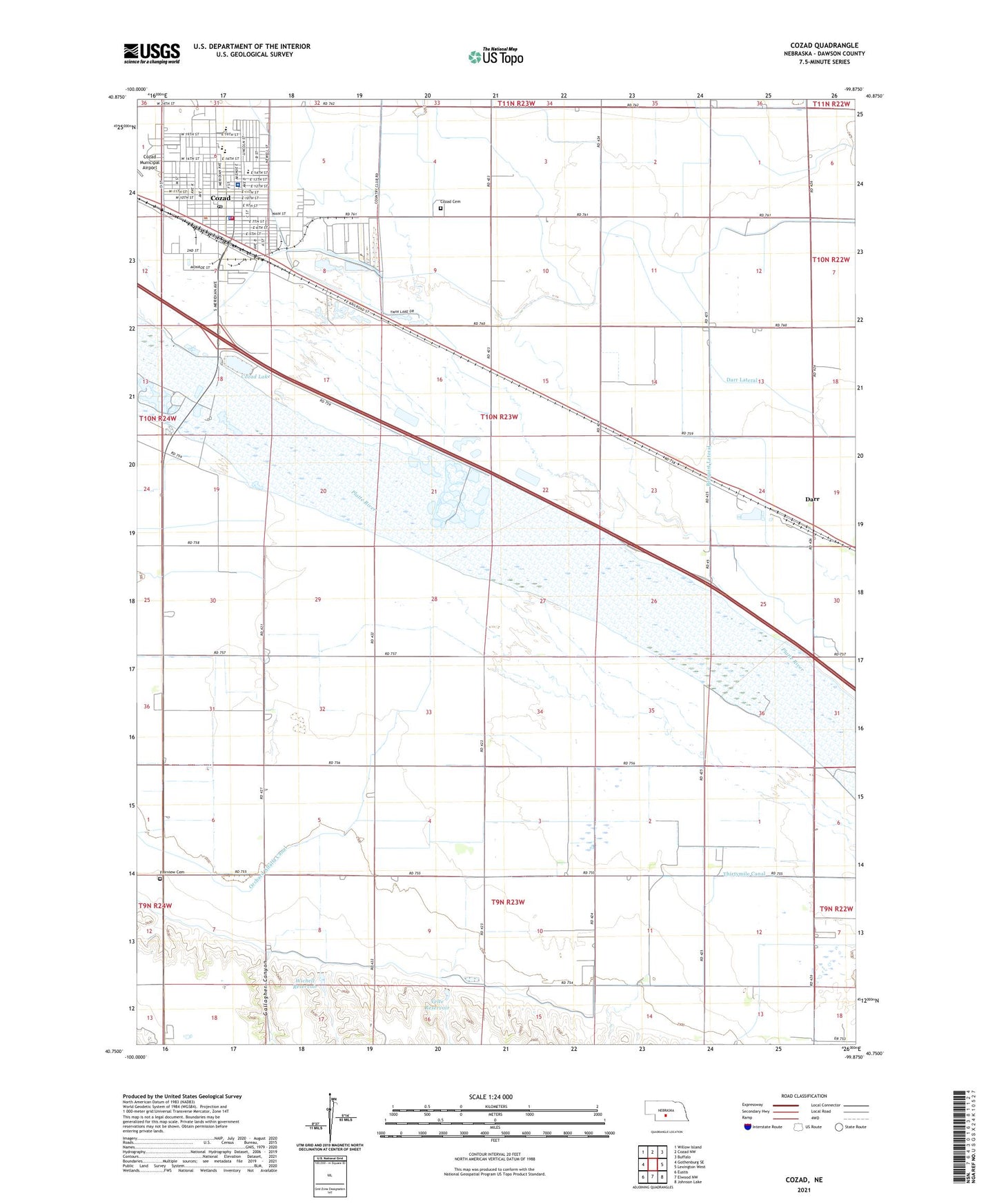
2021 topographic map quadrangle Cozad in the state of Nebraska. Scale: 1:24000. Based on the newly updated USGS 7.5' US Topo map series, this map is in the following counties: Dawson. The map contains contour data, water features, and other items you are used to seeing on USGS maps, but also has updated roads and other features. This is the next generation of topographic maps. Printed on high-quality waterproof paper with UV fade-resistant inks.
Quads adjacent to this one:
West: Gothenburg SE
Northwest: Willow Island
North: Cozad NW
Northeast: Buffalo
East: Lexington West
Southeast: Johnson Lake
South: Elwood NW
Southwest: Eustis
This map covers the same area as the classic USGS quad with code o40099g8.
Contains the following named places: American Lutheran Church, Bellamy Ballpark, Berean Fundamental Church, Centennial Park, Central Platte Valley Historical Marker, Central School, Christ the King Catholic Church, Church of Christ, Church of Christ West Twelfth Street, Church of God, City of Cozad, Community Bible Church, Cozad, Cozad Cemetery, Cozad Christian Church, Cozad City Park, Cozad Community Hospital, Cozad Community Medical Clinic, Cozad Country Club, Cozad Dental Clinic, Cozad Election Precinct, Cozad Fire Department, Cozad High School, Cozad Lake, Cozad Middle School, Cozad Police Department, Cozad Post Office, Cozad Rescue Squad, Cozad Rest Area Eastbound, Cozad Rest Area Westbound, Cozad State Wildlife Management Area, Cozad Vision Clinic, Darr, Darr Lateral, Darr Post Office, Darr Strip State Wildlife Management Area, Dawson County Diversion Dam, Dawson County Diversion Reservoir, Dawson County Drainage Ditch, East School, Fairview Cemetery, First Church of the Nazarene, First United Methodist Church, Frenchy Park, Gallagher Canyon, Horizon Mobile Home Park, KAMI-AM (Cozad), Living Hope Assembly of God Church, Muny Park, Muny Park Campground, North School, One Hundredth Meridian Museum, Presbyterian Church, Primitive Baptist Church, Ringgold Election Precinct, Robert Henri Museum and Historical Walkway, Saint Christopher Episcopal Church, Saint Johns Lutheran Church, School Number 19, School Number 29, School Number 37, School Number 66, Southview Manor Care Center, Sportsman Field, The 100th Meridian Historical Marker, Township of Cozad, Township of Ringgold, United Methodist Parkview Church, Velte Dam, Velte Reservoir, Wichelt Dam, Wichelt Reservoir, Wilson Public Library