MyTopo
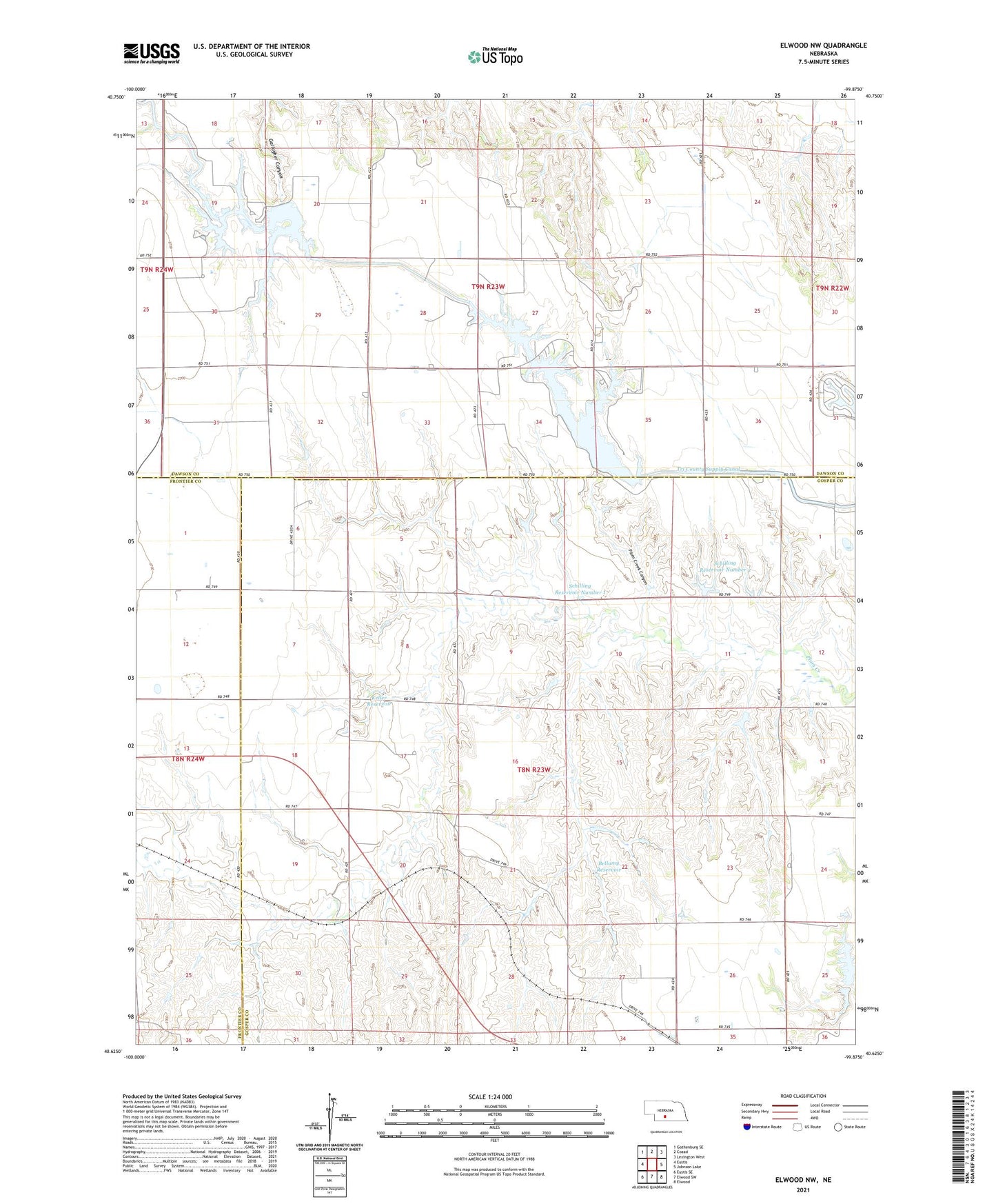
Elwood NW Nebraska US Topo Map
Couldn't load pickup availability
2021 topographic map quadrangle Elwood NW in the state of Nebraska. Scale: 1:24000. Based on the newly updated USGS 7.5' US Topo map series, this map is in the following counties: Gosper, Dawson, Frontier. The map contains contour data, water features, and other items you are used to seeing on USGS maps, but also has updated roads and other features. This is the next generation of topographic maps. Printed on high-quality waterproof paper with UV fade-resistant inks.
Quads adjacent to this one:
West: Eustis
Northwest: Gothenburg SE
North: Cozad
Northeast: Lexington West
East: Johnson Lake
Southeast: Elwood
South: Elwood SW
Southwest: Eustis SE
This map covers the same area as the classic USGS quad with code o40099f8.
Contains the following named places: Bellamy Dam, Bellamy Reservoir, Brace Election Precinct, Earth Dam Canal Mile 605, Earth Dam-Canal Mile 567 Dam, Earth Dam-Canal Mile 608 Dam, Franta Dam, Franta Reservoir, Gallagher Canyon State Recreation Area, Keller Dam, Keller Reservoir, Plum Creek Canyon, Plum Creek State Recreation Area, Schilling Dam Number 1, Schilling Dam Number 2, Schilling Reservoir Number 1, Schilling Reservoir Number 2, Township of Brace