MyTopo
Grafton Nebraska US Topo Map
Couldn't load pickup availability
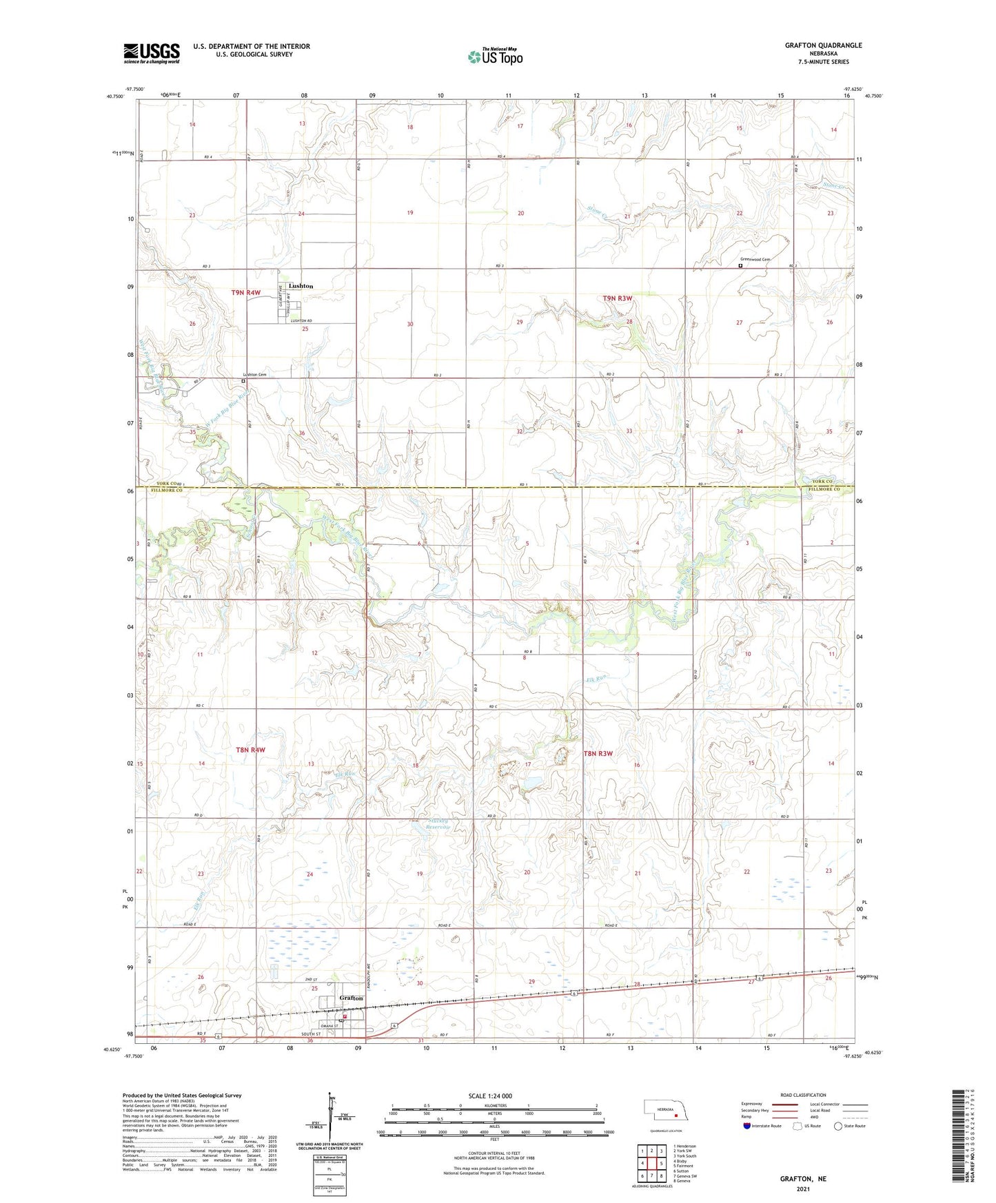
2021 topographic map quadrangle Grafton in the state of Nebraska. Scale: 1:24000. Based on the newly updated USGS 7.5' US Topo map series, this map is in the following counties: Fillmore, York. The map contains contour data, water features, and other items you are used to seeing on USGS maps, but also has updated roads and other features. This is the next generation of topographic maps. Printed on high-quality waterproof paper with UV fade-resistant inks.
Quads adjacent to this one:
West: Bixby
Northwest: Henderson
North: York SW
Northeast: York South
East: Fairmont
Southeast: Geneva
South: Geneva SW
Southwest: Sutton
Contains the following named places: Bluebill State Wildlife Management Area, Elk Run, Farmers Cooperative Association Elevator, Grafton, Grafton Post Office, Grafton Public School, Grafton Rural Fire District, Greenwood Cemetery, Hays Election Precinct, Lushton, Lushton Cemetery, Lushton Post Office, Marsh Hawk State Wildlife Management Area, Saint Helena Catholic Church, School Creek, Stuckey Dam, Stuckey Reservoir, Sutton Cooperative Grain Company Elevator, Township of Hays, Township of West Blue, Village of Grafton, Village of Lushton