MyTopo
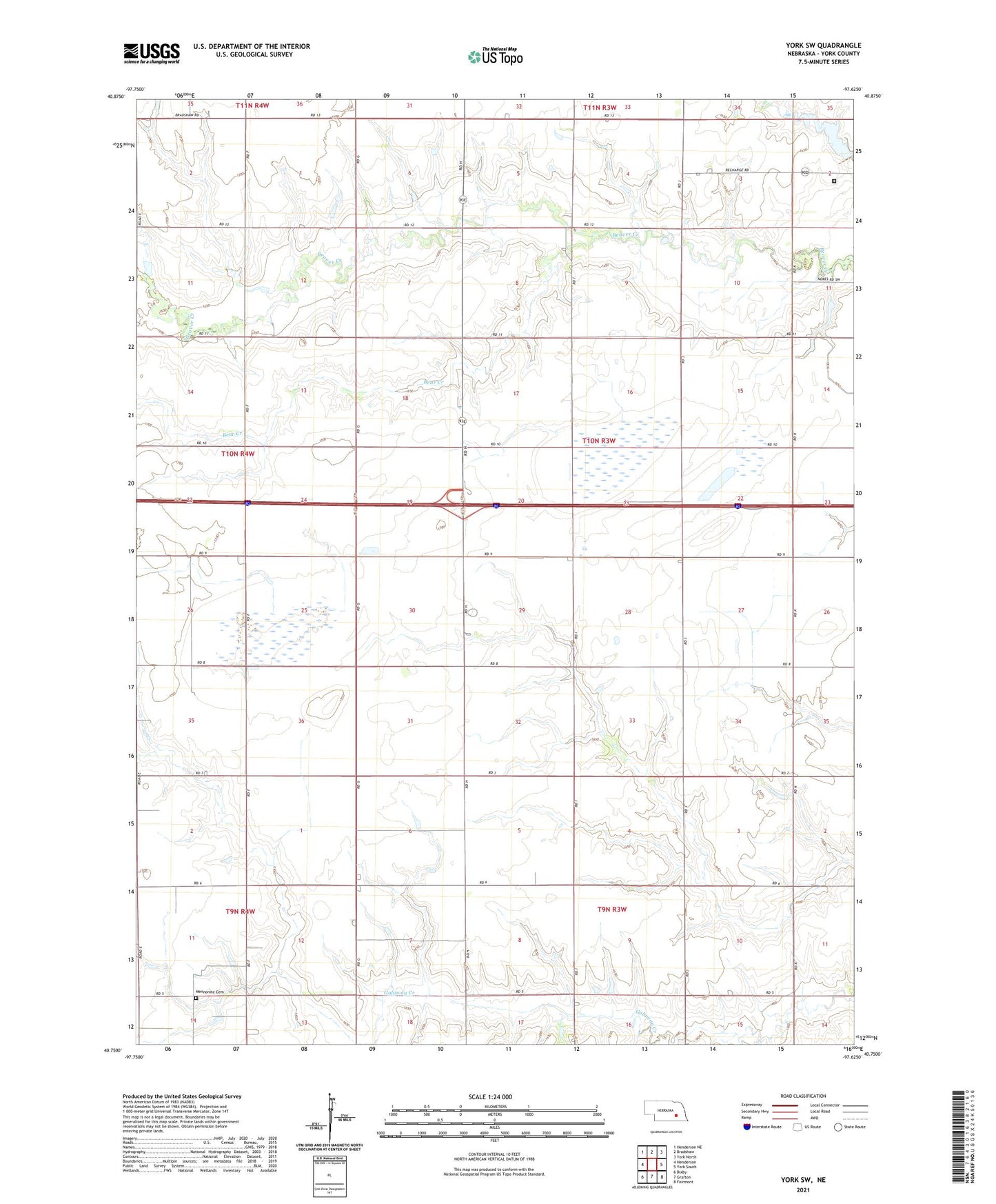
York SW Nebraska US Topo Map
Couldn't load pickup availability
2021 topographic map quadrangle York SW in the state of Nebraska. Scale: 1:24000. Based on the newly updated USGS 7.5' US Topo map series, this map is in the following counties: York. The map contains contour data, water features, and other items you are used to seeing on USGS maps, but also has updated roads and other features. This is the next generation of topographic maps. Printed on high-quality waterproof paper with UV fade-resistant inks.
Quads adjacent to this one:
West: Henderson
Northwest: Henderson NE
North: Bradshaw
Northeast: York North
East: York South
Southeast: Fairmont
South: Grafton
Southwest: Bixby
This map covers the same area as the classic USGS quad with code o40097g6.
Contains the following named places: Baker Election Precinct, Bear Creek, Centennial School, Charlestown, Charlestown Post Office, Council Church, Kirkpatrick Basin North State Wildlife Management Area, Kirkpatrick Basin South State Wildlife Management Area, Mennonite Cemetery, Nebraska City-Fort Kearny Cut-off Historical Marker, Nebraska Correctional Center for Women, Recharge Lake, Township of Baker, York Rest Area - Eastbound