MyTopo
Harvard Nebraska US Topo Map
Couldn't load pickup availability
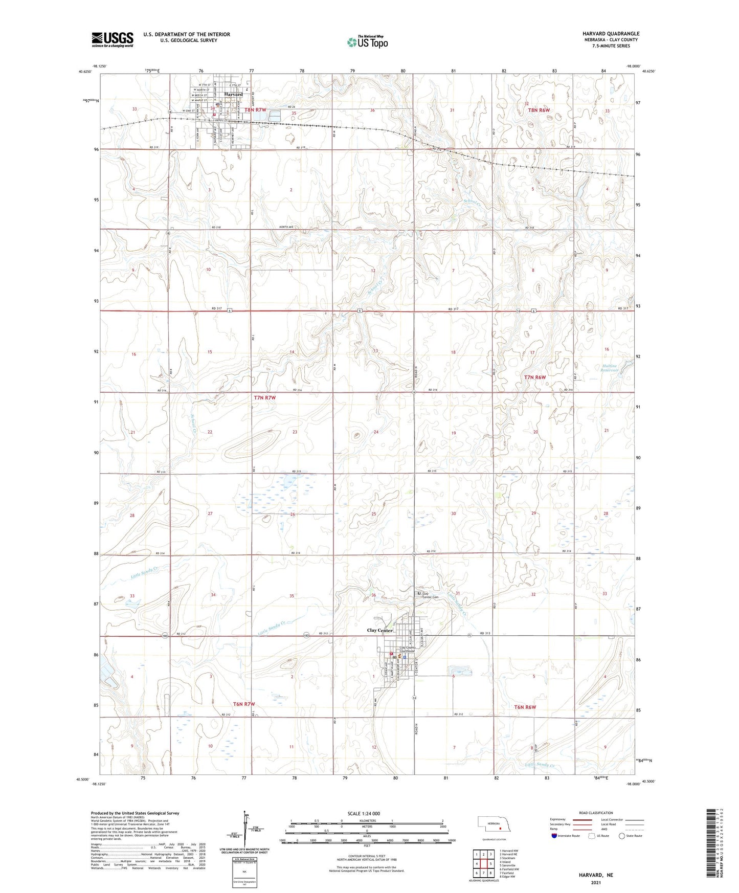
2021 topographic map quadrangle Harvard in the state of Nebraska. Scale: 1:24000. Based on the newly updated USGS 7.5' US Topo map series, this map is in the following counties: Clay. The map contains contour data, water features, and other items you are used to seeing on USGS maps, but also has updated roads and other features. This is the next generation of topographic maps. Printed on high-quality waterproof paper with UV fade-resistant inks.
Quads adjacent to this one:
West: Inland
Northwest: Harvard NW
North: Harvard NE
Northeast: Stockham
East: Saronville
Southeast: Edgar NW
South: Fairfield
Southwest: Fairfield NW
Contains the following named places: Aurora Cooperative Elevator Company Elevator, City of Clay Center, City of Harvard, Clay Center, Clay Center Cemetery, Clay Center Community Medical Clinic, Clay Center Dental Clinic, Clay Center Historical Marker, Clay Center Police Department, Clay Center Post Office, Clay Center Public Library, Clay Center Public Schools, Clay Center Volunteer Ambulance, Clay Center Volunteer Fire Department, Clay County, Clay County Courthouse, Clay County Fairground, Clay County Sheriff's Office, Crooked Creek Country Club, Harvard, Harvard City Park, Harvard Historical Marker, Harvard Police Department, Harvard Post Office, Harvard Public Library, Harvard Public Schools, Harvard Rest Haven, Harvard Volunteer Fire and Rescue, Hultine Dam, Hultine Reservoir, Saint Joseph Catholic Church, Township of Lynn, United Church of Christ, United Methodist Church, Zion Lutheran Church, ZIP Code: 68933