MyTopo
Harvard NW Nebraska US Topo Map
Couldn't load pickup availability
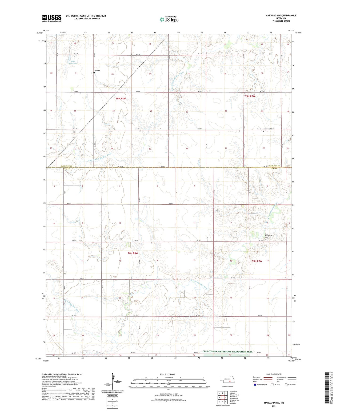
2021 topographic map quadrangle Harvard NW in the state of Nebraska. Scale: 1:24000. Based on the newly updated USGS 7.5' US Topo map series, this map is in the following counties: Clay, Hamilton. The map contains contour data, water features, and other items you are used to seeing on USGS maps, but also has updated roads and other features. This is the next generation of topographic maps. Printed on high-quality waterproof paper with UV fade-resistant inks.
Quads adjacent to this one:
West: Trumbull
Northwest: Doniphan
North: Giltner
Northeast: Aurora West
East: Harvard NE
Southeast: Harvard
South: Inland
Southwest: Hastings East
This map covers the same area as the classic USGS quad with code o40098f2.
Contains the following named places: Bish Dam, Bish Reservoir, Case Cemetery, First Evangelical Cemetery, Greenwood Cemetery, Reiters Landing Strip, Township of Leicester, Township of Scovill