MyTopo
Hershey West Nebraska US Topo Map
Couldn't load pickup availability
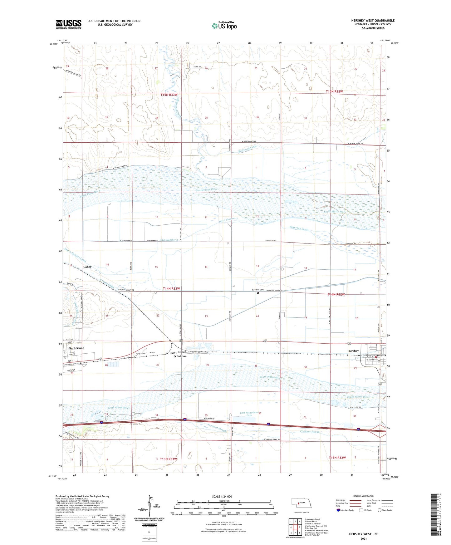
2021 topographic map quadrangle Hershey West in the state of Nebraska. Scale: 1:24000. Based on the newly updated USGS 7.5' US Topo map series, this map is in the following counties: Lincoln. The map contains contour data, water features, and other items you are used to seeing on USGS maps, but also has updated roads and other features. This is the next generation of topographic maps. Printed on high-quality waterproof paper with UV fade-resistant inks.
Quads adjacent to this one:
West: Sutherland Reservoir NW
Northwest: Applegate Ranch
North: Green Ranch
Northeast: North of Hershey
East: Hershey East
Southeast: North Platte SW
South: Sutherland Reservoir East
Southwest: Sutherland Reservoir West
This map covers the same area as the classic USGS quad with code o41101b1.
Contains the following named places: Birdwood Creek, Coker, Crossing the Overland Trail Historical Marker, Ditch Number 3, East Sutherland Lake, East Sutherland State Wildlife Management Area, George Airport, Great Platte River Road Historical Marker, Hershey, Hershey Baptist Church, Hershey Election Precinct, Hershey Post Office, Hershey Public Schools, Hershey Volunteer Fire Department South Fire Hall, KJs Korner Campground, Maria Lutheran Church, Methodist Church, O'Fallons, O'Fallons School, Our Lady of Guadalupe Church, Paxton Hershey Canal, Riverside Cemetery, Scoular Grain Elevator, Suburban Canal, Sutherland Eastbound Travel Information Center, Sutherland Rest Area - Eastbound, Sutherland Rest Area - Westbound, The Church of Jesus Christ of Latter Day Saints, United Methodist Church, Village of Sutherland, ZIP Code: 69143