MyTopo
Hessey Lake Nebraska US Topo Map
Couldn't load pickup availability
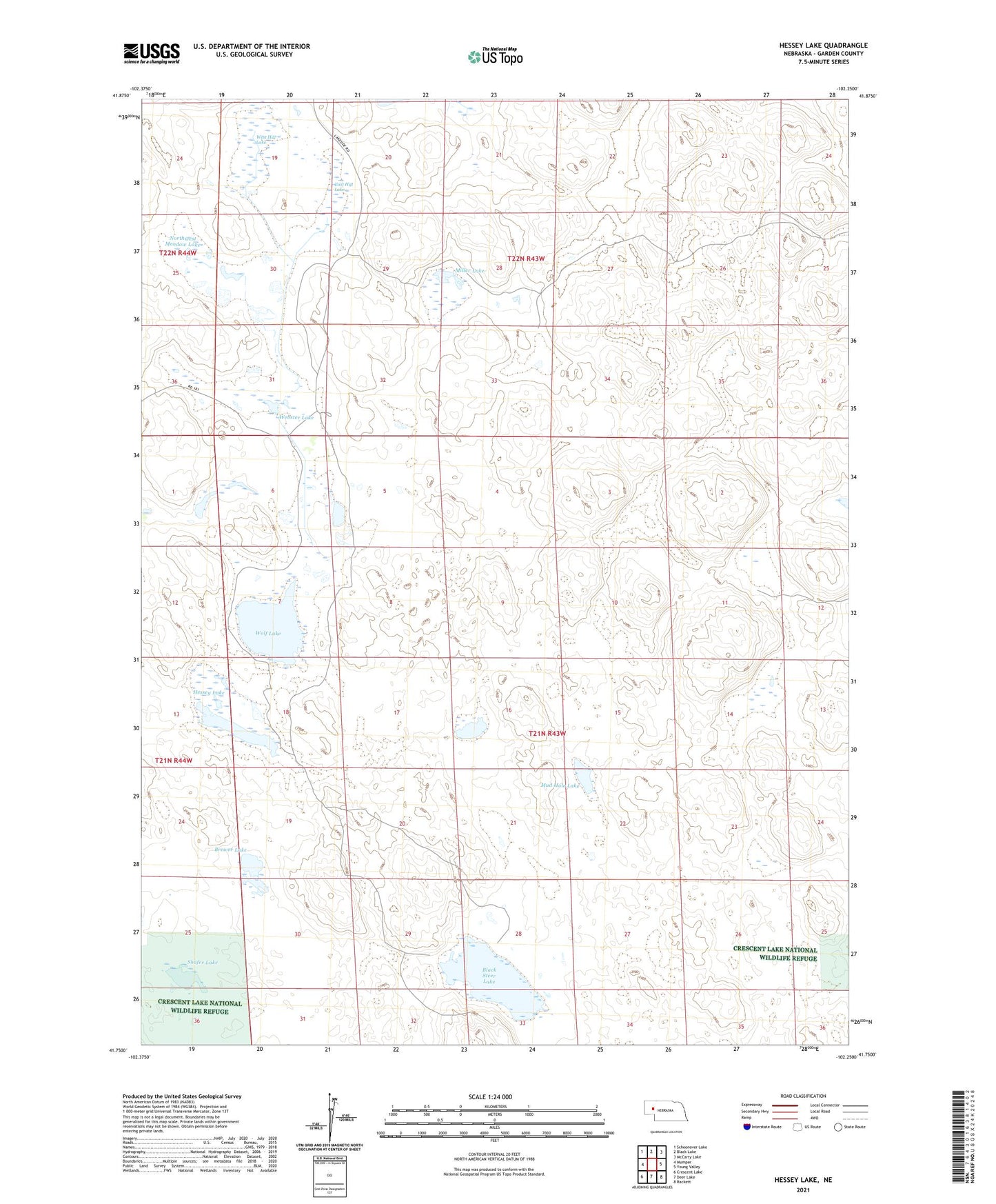
2021 topographic map quadrangle Hessey Lake in the state of Nebraska. Scale: 1:24000. Based on the newly updated USGS 7.5' US Topo map series, this map is in the following counties: Garden. The map contains contour data, water features, and other items you are used to seeing on USGS maps, but also has updated roads and other features. This is the next generation of topographic maps. Printed on high-quality waterproof paper with UV fade-resistant inks.
Quads adjacent to this one:
West: Mumper
Northwest: Schoonover Lake
North: Black Lake
Northeast: McCarty Lake
East: Young Valley
Southeast: Rackett
South: Deer Lake
Southwest: Crescent Lake
This map covers the same area as the classic USGS quad with code o41102g3.
Contains the following named places: Black Steer Lake, Brewer Lake, East Hill Lake, Hessey Lake, Miller Lake, Mud Hole Lake, Northwest Meadow Lake, Pawlet Ranch, Pawlet Ranch Airport, School Number 73, Shafer Lake, Webster Lake, West Hill Lake, Wolf Lake, Young Ranch