MyTopo
Hog Island Nebraska US Topo Map
Couldn't load pickup availability
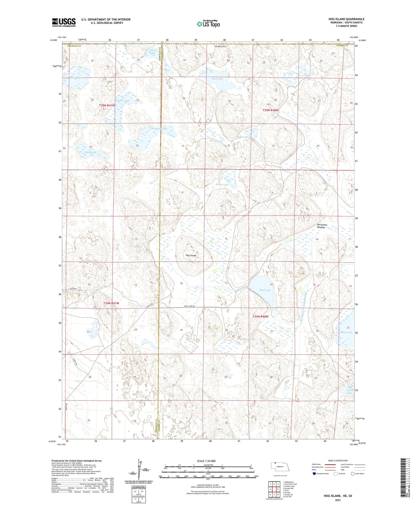
2021 topographic map quadrangle Hog Island in the state of Nebraska. Scale: 1:24000. Based on the newly updated USGS 7.5' US Topo map series, this map is in the following counties: Cherry, Sheridan, Bennett, Oglala Lakota. The map contains contour data, water features, and other items you are used to seeing on USGS maps, but also has updated roads and other features. This is the next generation of topographic maps. Printed on high-quality waterproof paper with UV fade-resistant inks.
Quads adjacent to this one:
West: Gordon NW
Northwest: Wakpamani
North: Two Lance Lake
Northeast: Ecoffey Lake
East: Irwin
Southeast: Irwin SW
South: Gordon SE
Southwest: Gordon
Contains the following named places: Dads Lake, Esther Lake, Frye Lake, Hog Island, Hoover Lake, Horseshoe Drainage Ditch, Horseshoe Meadow, Larson Lake, Log Cabin Lake, Mullis Lake, Powell Lake, Rush Lake, Shell Lake, Shell Lake Dam, Shell Lake State Wildlife Management Area, Thompson Lake, Trucks Lake