MyTopo
Horn Nebraska US Topo Map
Couldn't load pickup availability
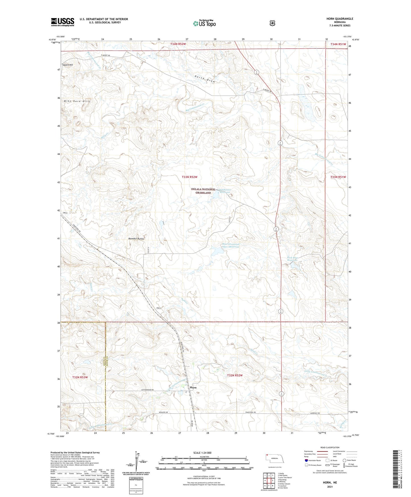
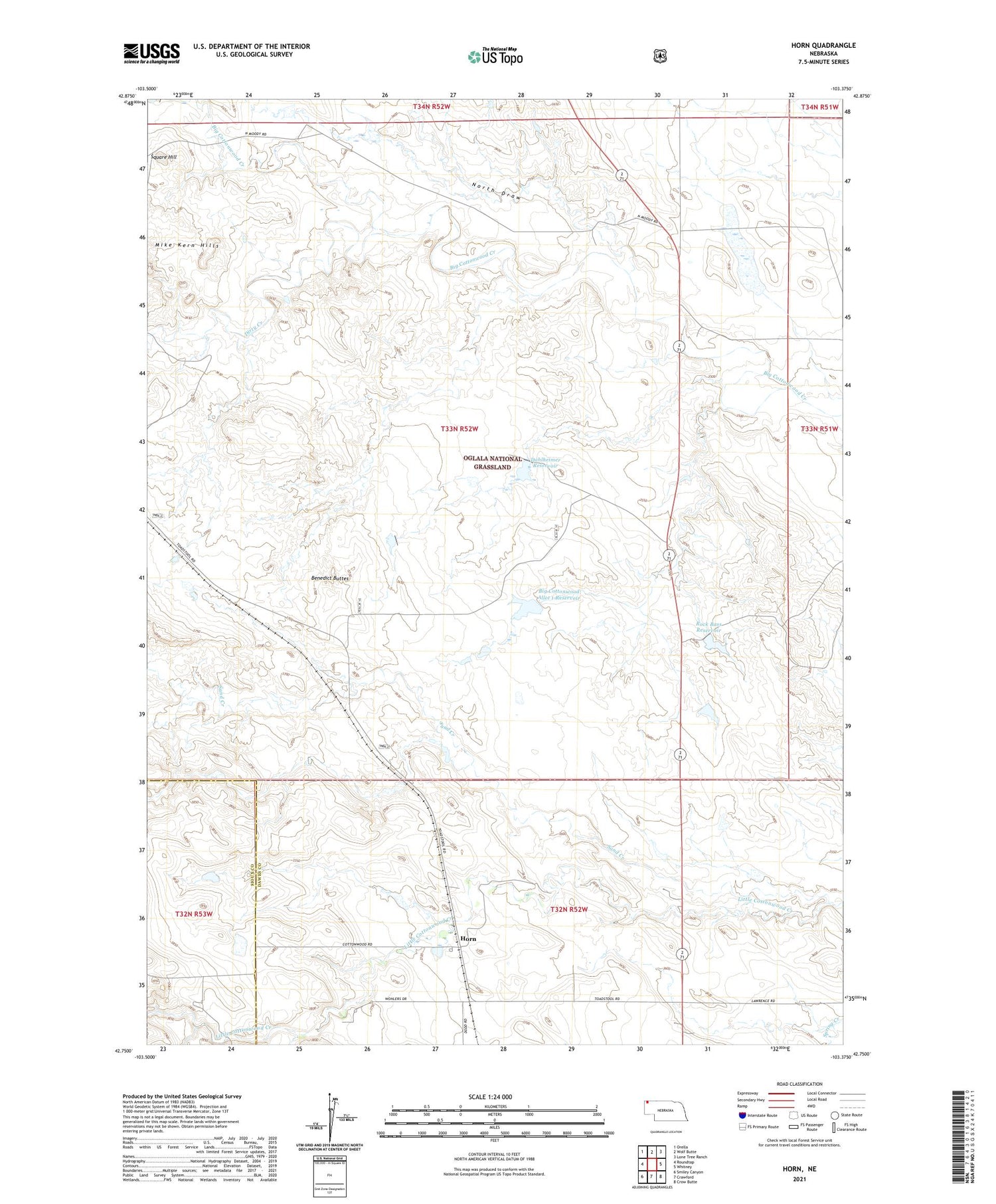
2021 topographic map quadrangle Horn in the state of Nebraska. Scale: 1:24000. Based on the newly updated USGS 7.5' US Topo map series, this map is in the following counties: Dawes, Sioux. The map contains contour data, water features, and other items you are used to seeing on USGS maps, but also has updated roads and other features. This is the next generation of topographic maps. Printed on high-quality waterproof paper with UV fade-resistant inks.
Quads adjacent to this one:
West: Roundtop
Northwest: Orella
North: Wolf Butte
Northeast: Lone Tree Ranch
East: Whitney
Southeast: Crow Butte
South: Crawford
Southwest: Smiley Canyon
Contains the following named places: Benedict Buttes, Big Cottonwood Allot 1 Dam, Big Cottonwood Allot 1 Reservoir, Big Cottonwood Allot 2 Dam, Big Cottonwood Allot 2 Reservoir, Dahlheimer Dam, Dahlheimer Reservoir, Dirty Creek, Dodd-McDowell Dam, Dodd-McDowell Reservoir, Election Precinct 11, Horn, Mike Kern Hills, North Draw, Rock Bass Allot 2 Dam, Rock Bass Reservoir, Sand Creek, Square Hill, Willowdale School