MyTopo
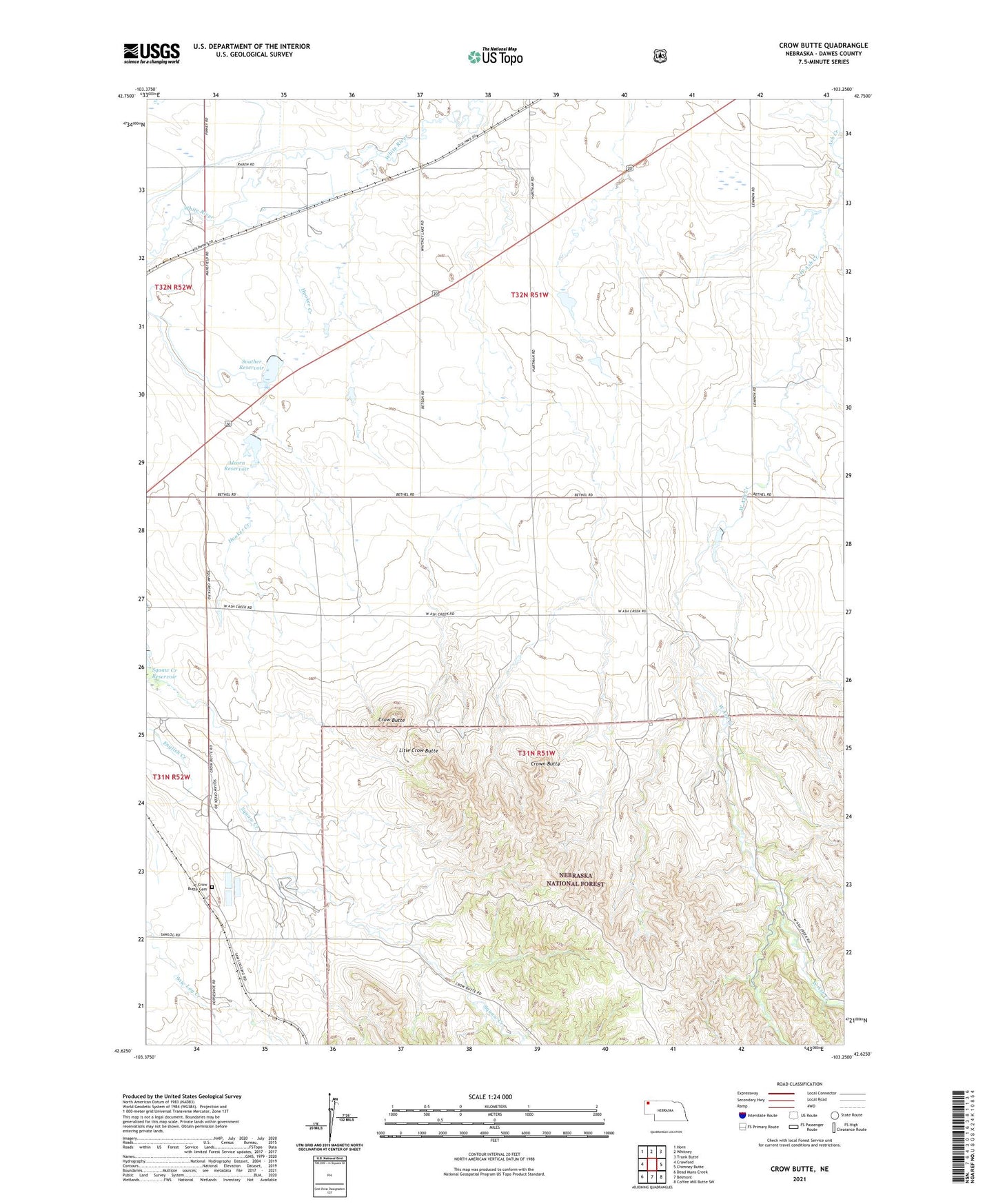
Crow Butte Nebraska US Topo Map
Couldn't load pickup availability
Also explore the Crow Butte Forest Service Topo of this same quad for updated USFS data
2023 topographic map quadrangle Crow Butte in the state of Nebraska. Scale: 1:24000. Based on the newly updated USGS 7.5' US Topo map series, this map is in the following counties: Dawes. The map contains contour data, water features, and other items you are used to seeing on USGS maps, but also has updated roads and other features. This is the next generation of topographic maps. Printed on high-quality waterproof paper with UV fade-resistant inks.
Quads adjacent to this one:
West: Crawford
Northwest: Horn
North: Whitney
Northeast: Trunk Butte
East: Chimney Butte
Southeast: Coffee Mill Butte SW
South: Belmont
Southwest: Dead Mans Creek
This map covers the same area as the classic USGS quad with code o42103f3.
Contains the following named places: Agate Reservoir, Alcorn Dam, Alcorn Reservoir, Butte Country Historical Marker, Crow Butte, Crow Butte Cemetery, Crown Butte, East Ash Creek, Hooker Creek, Litle Crow Butte, Ponderosa State Special Use Area, Souther Dam, Souther Reservoir, Squaw Creek Dam