MyTopo
Humphrey Nebraska US Topo Map
Couldn't load pickup availability
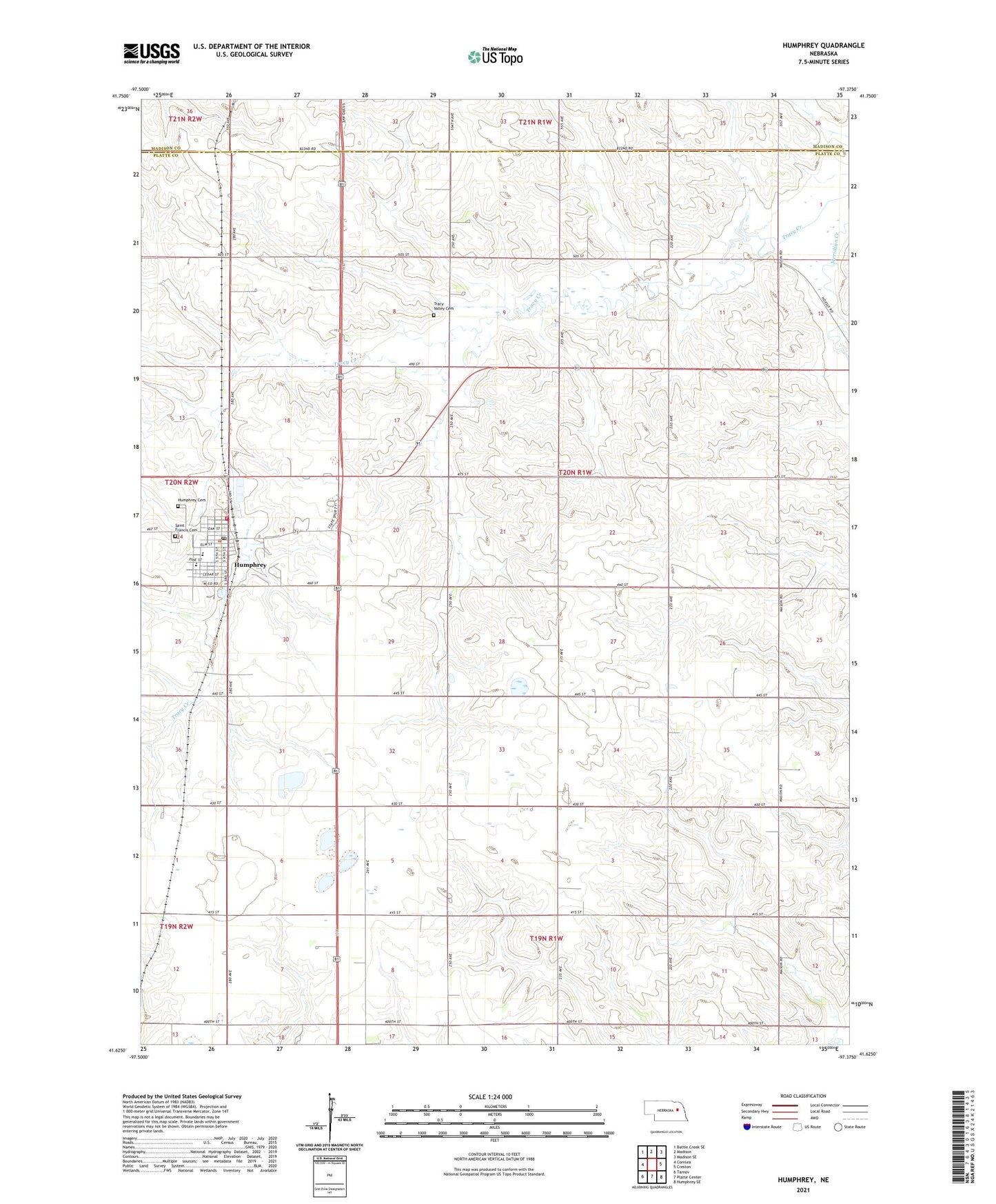
2021 topographic map quadrangle Humphrey in the state of Nebraska. Scale: 1:24000. Based on the newly updated USGS 7.5' US Topo map series, this map is in the following counties: Platte, Madison. The map contains contour data, water features, and other items you are used to seeing on USGS maps, but also has updated roads and other features. This is the next generation of topographic maps. Printed on high-quality waterproof paper with UV fade-resistant inks.
Quads adjacent to this one:
West: Cornlea
Northwest: Battle Creek SE
North: Madison
Northeast: Madison SE
East: Creston
Southeast: Humphrey SE
South: Platte Center
Southwest: Tarnov
Contains the following named places: City of Humphrey, Humphrey, Humphrey Cemetery, Humphrey Medical Clinic, Humphrey Police Department, Humphrey Post Office, Humphrey Public Library, Humphrey Public Schools, Humphrey Volunteer Fire and Rescue, Husker Co-op Elevator, Saint Francis Cemetery, Saint Francis Central High School, Saint Francis Church, Saint Francis Elementary School, Saint Mary Post Office, Saint Marys Church, Steepleview Golf Course, Township of Humphrey, Tracy Valley Cemetery