MyTopo
Tarnov Nebraska US Topo Map
Couldn't load pickup availability
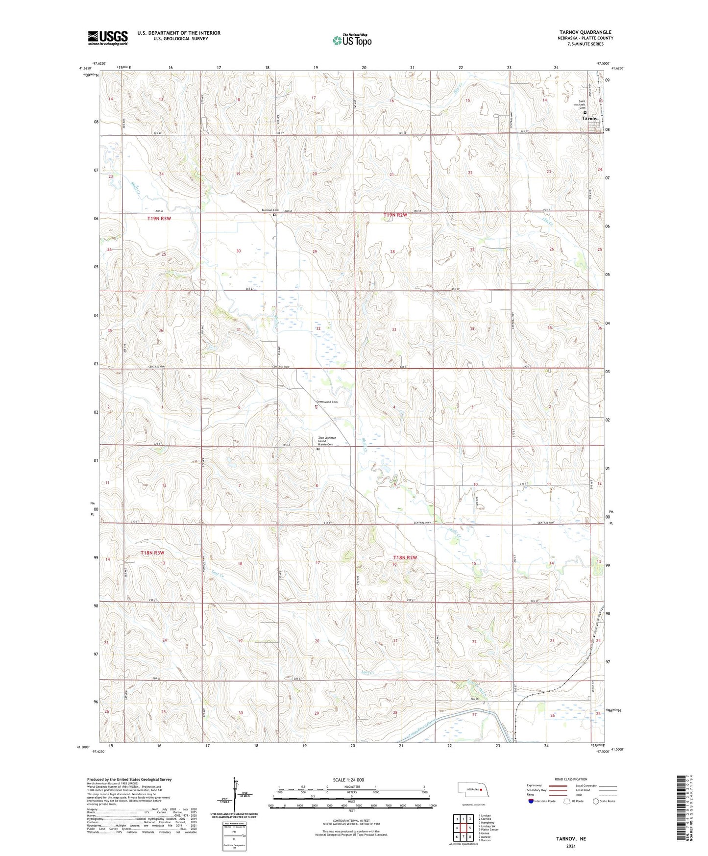
2021 topographic map quadrangle Tarnov in the state of Nebraska. Scale: 1:24000. Based on the newly updated USGS 7.5' US Topo map series, this map is in the following counties: Platte. The map contains contour data, water features, and other items you are used to seeing on USGS maps, but also has updated roads and other features. This is the next generation of topographic maps. Printed on high-quality waterproof paper with UV fade-resistant inks.
Quads adjacent to this one:
West: Lindsay SW
Northwest: Lindsay
North: Cornlea
Northeast: Humphrey
East: Platte Center
Southeast: Duncan
South: Monroe
Southwest: Genoa
This map covers the same area as the classic USGS quad with code o41097e5.
Contains the following named places: Burrows Cemetery, Greenwood Cemetery, Lost Creek, Platte County, Postville Church, Saint Anthony Post Office, Saint Anthonys Church, Saint Michaels Catholic Church, Saint Michaels Cemetery, School Number 11, School Number 60, Tarnov, Tarnov Post Office, Township of Burrows, Township of Lost Creek, Village of Tarnov, Wattsville School, Zion Lutheran Grand Prairie Cemetery