MyTopo
Madison SE Nebraska US Topo Map
Couldn't load pickup availability
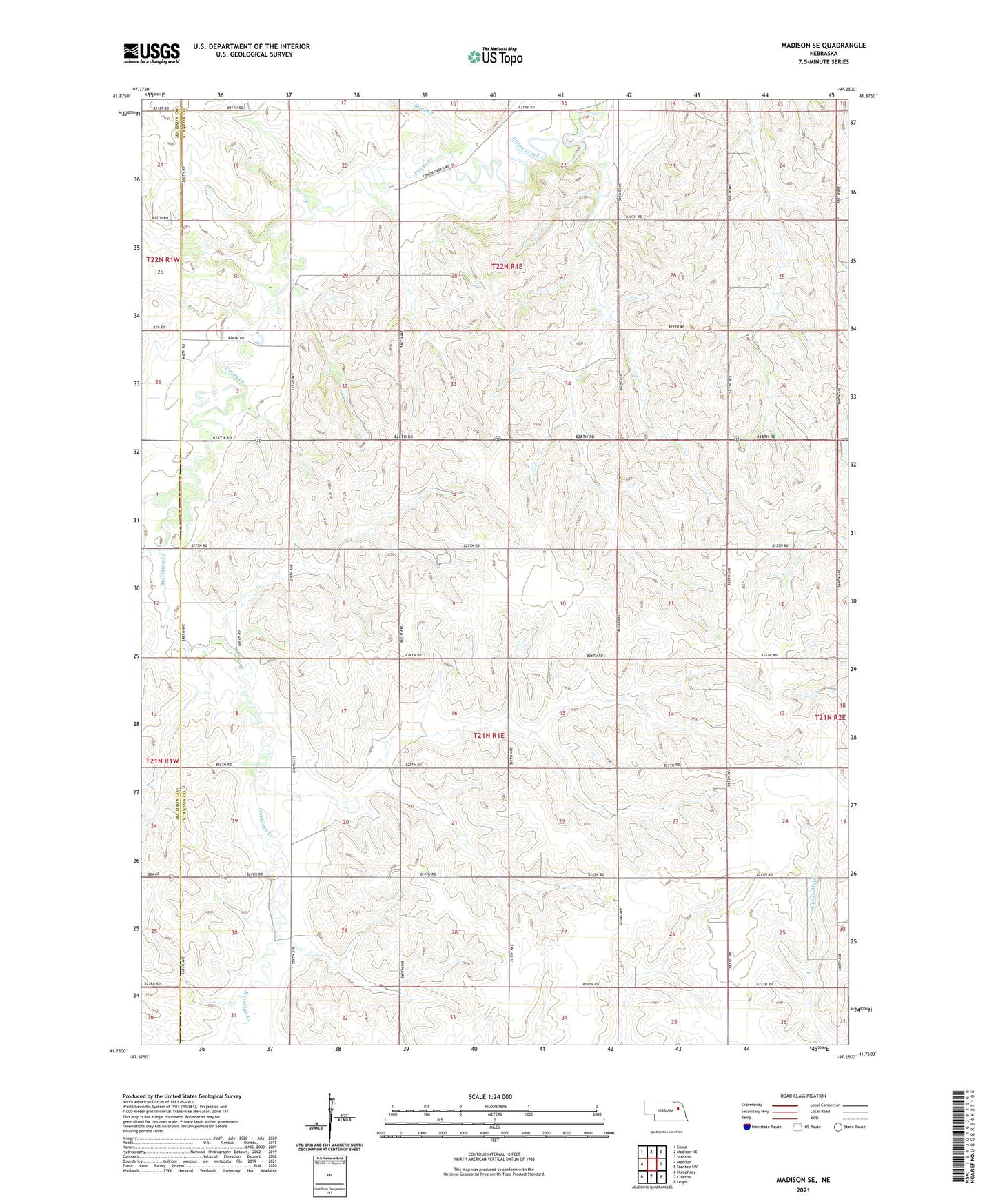
2021 topographic map quadrangle Madison SE in the state of Nebraska. Scale: 1:24000. Based on the newly updated USGS 7.5' US Topo map series, this map is in the following counties: Stanton, Madison. The map contains contour data, water features, and other items you are used to seeing on USGS maps, but also has updated roads and other features. This is the next generation of topographic maps. Printed on high-quality waterproof paper with UV fade-resistant inks.
Quads adjacent to this one:
West: Madison
Northwest: Enola
North: Madison NE
Northeast: Stanton
East: Stanton SW
Southeast: Leigh
South: Creston
Southwest: Humphrey
This map covers the same area as the classic USGS quad with code o41097g3.
Contains the following named places: Dimick Election Precinct, Meridian Creek, Sand Creek, School Number 17, School Number 20, School Number 37, School Number 39, School Number 42, School Number 48, School Number 54, Township of Dimick, Township of Union Creek, Union Creek Election Precinct