MyTopo
Kennard Nebraska US Topo Map
Couldn't load pickup availability
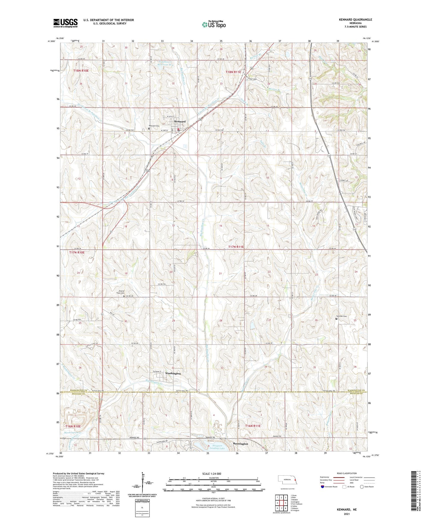
2021 topographic map quadrangle Kennard in the state of Nebraska. Scale: 1:24000. Based on the newly updated USGS 7.5' US Topo map series, this map is in the following counties: Washington, Douglas. The map contains contour data, water features, and other items you are used to seeing on USGS maps, but also has updated roads and other features. This is the next generation of topographic maps. Printed on high-quality waterproof paper with UV fade-resistant inks.
Quads adjacent to this one:
West: Arlington
Northwest: Orum
North: Blair
Northeast: Modale
East: Fort Calhoun
Southeast: Irvington
South: Elkhorn
Southwest: Valley
Contains the following named places: Boston Branch, Butter Flat Creek, Douglas County Landfill, East Fork Big Papillion Creek, Emmaus Lutheran Church, Falls Branch, Fort Atkinson Historical Marker, German Cemetery, Grace United Methodist Church, Kennard, Kennard Cemetery, Kennard Post Office, Kennard Volunteer Fire and Rescue, Leach Branch, Maney School, North Washington Creek, Northwest Branch Big Papillion Creek, Northwest Branch Papillion Creek, Papillion Creek Dam W-4, Papillion Creek Reservoir W-4, Prairie View Cemetery, Richter Branch, School Number 32, South Washington Creek, Southwest Branch Big Papillion Creek, Sunny Side School, Township of Blair, Village of Kennard, Village of Washington, Washington, Washington Creek, Washington Post Office, Washington Public School, ZIP Codes: 68034, 68068