MyTopo
Leshara Nebraska US Topo Map
Couldn't load pickup availability
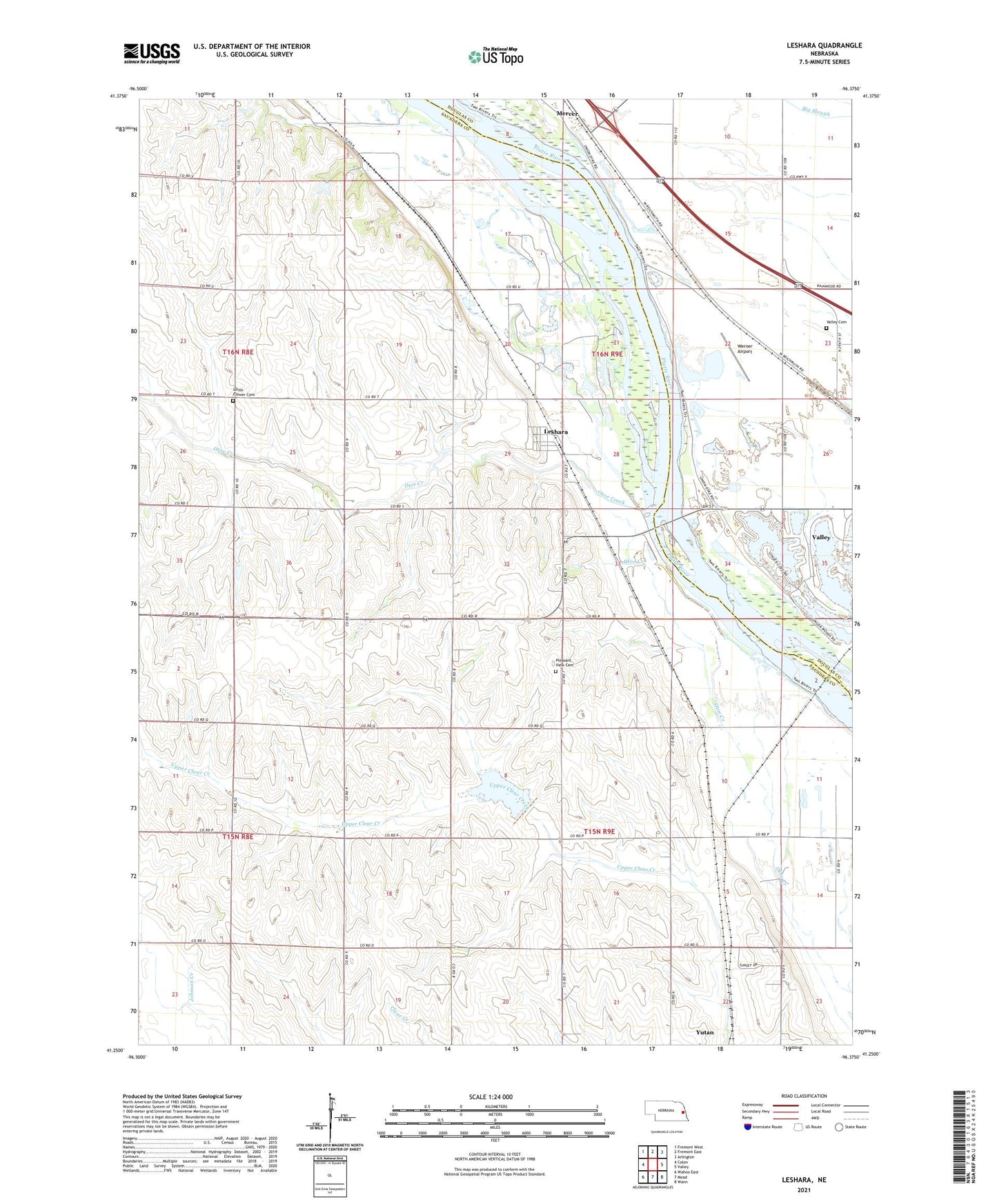
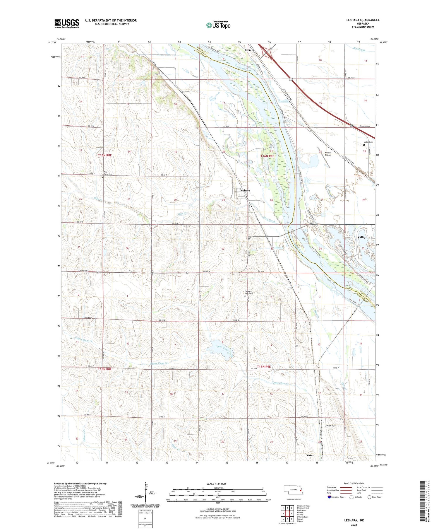
2021 topographic map quadrangle Leshara in the state of Nebraska. Scale: 1:24000. Based on the newly updated USGS 7.5' US Topo map series, this map is in the following counties: Saunders, Douglas. The map contains contour data, water features, and other items you are used to seeing on USGS maps, but also has updated roads and other features. This is the next generation of topographic maps. Printed on high-quality waterproof paper with UV fade-resistant inks.
Quads adjacent to this one:
West: Colon
Northwest: Fremont West
North: Fremont East
Northeast: Arlington
East: Valley
Southeast: Wann
South: Mead
Southwest: Wahoo East
Contains the following named places: Community Church, Elm Tree Public School, Leshara, Leshara Post Office, Little Flower Cemetery, Mercer, Mercer School, Otoe Creek, Pleasant View Cemetery, School Number 119, Township of Leshara, Township of Union, Valley Cemetery, Village of Leshara, Werner Airport, ZIP Code: 68073