MyTopo
Wann Nebraska US Topo Map
Couldn't load pickup availability
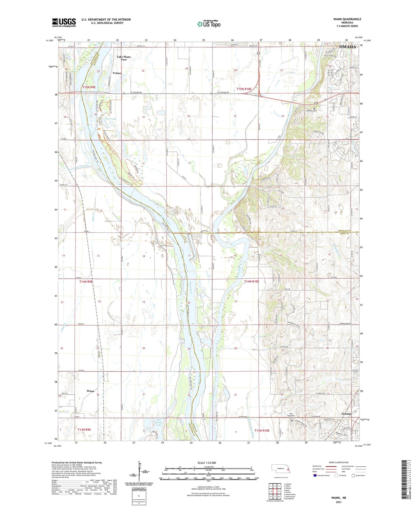
2021 topographic map quadrangle Wann in the state of Nebraska. Scale: 1:24000. Based on the newly updated USGS 7.5' US Topo map series, this map is in the following counties: Douglas, Saunders, Sarpy. The map contains contour data, water features, and other items you are used to seeing on USGS maps, but also has updated roads and other features. This is the next generation of topographic maps. Printed on high-quality waterproof paper with UV fade-resistant inks.
Quads adjacent to this one:
West: Mead
Northwest: Leshara
North: Valley
Northeast: Elkhorn
East: Gretna
Southeast: Springfield
South: Ashland East
Southwest: Ashland West
This map covers the same area as the classic USGS quad with code o41096b3.
Contains the following named places: Big Sandy Lake, Caboose Park, Circle R Camp, Cottonwood Campground, Diversion Channel, Elkhorn Cemetery, Fawn Meadows Campground, Goldenrod Campground, Gretna Middle School, Holy Sepulcher Cemetery, KPQC-TV (Omaha), Lake Platte View, Oak Grove Campground, Oto Indians Historical Marker, Otoe Creek, Riverside Campground, Skyline Woods Country Club, Township of Forest City, Trout Lake, Two Rivers Church, Two Rivers Farm, Two Rivers School, Two Rivers State Recreation Area, Venice, Venice Census Designated Place, Wann, Wann Census Designated Place, Wann Post Office, Woods Landing Campground and RV Park, ZIP Code: 68069