MyTopo
Colon Nebraska US Topo Map
Couldn't load pickup availability
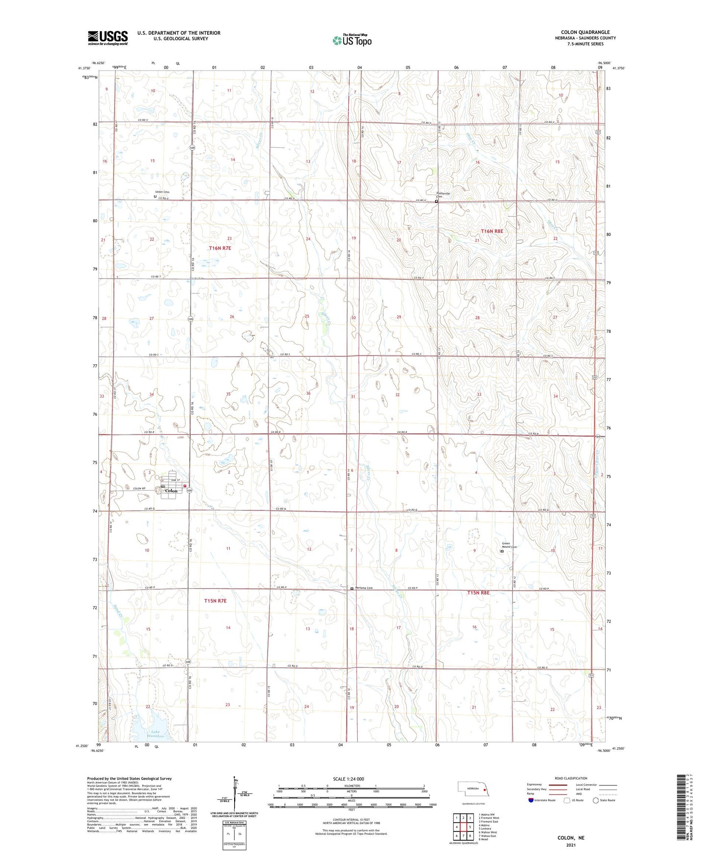
2021 topographic map quadrangle Colon in the state of Nebraska. Scale: 1:24000. Based on the newly updated USGS 7.5' US Topo map series, this map is in the following counties: Saunders. The map contains contour data, water features, and other items you are used to seeing on USGS maps, but also has updated roads and other features. This is the next generation of topographic maps. Printed on high-quality waterproof paper with UV fade-resistant inks.
Quads adjacent to this one:
West: Malmo
Northwest: Malmo NW
North: Fremont West
Northeast: Fremont East
East: Leshara
Southeast: Mead
South: Wahoo East
Southwest: Wahoo West
This map covers the same area as the classic USGS quad with code o41096c5.
Contains the following named places: Cathedral of Praise, Colon, Colon Elevator Company Elevator, Colon Post Office, Colon Volunteer Fire Department, Duck Creek, Green Mound Cemetery, Marietta Cemetery, Marietta Church, Mead Emmanuel Church, Platteville Cemetery, Pohocco Church, Saint Joseph Catholic Church, Sand Creek, School Number 60, School Number 65, School Number 82, Standard Public School, Township of Center, Township of Marietta, Township of Pohocco, Township of South Cedar, Union Cemetery, Village of Colon, ZIP Code: 68018