MyTopo
Lewiston Nebraska US Topo Map
Couldn't load pickup availability
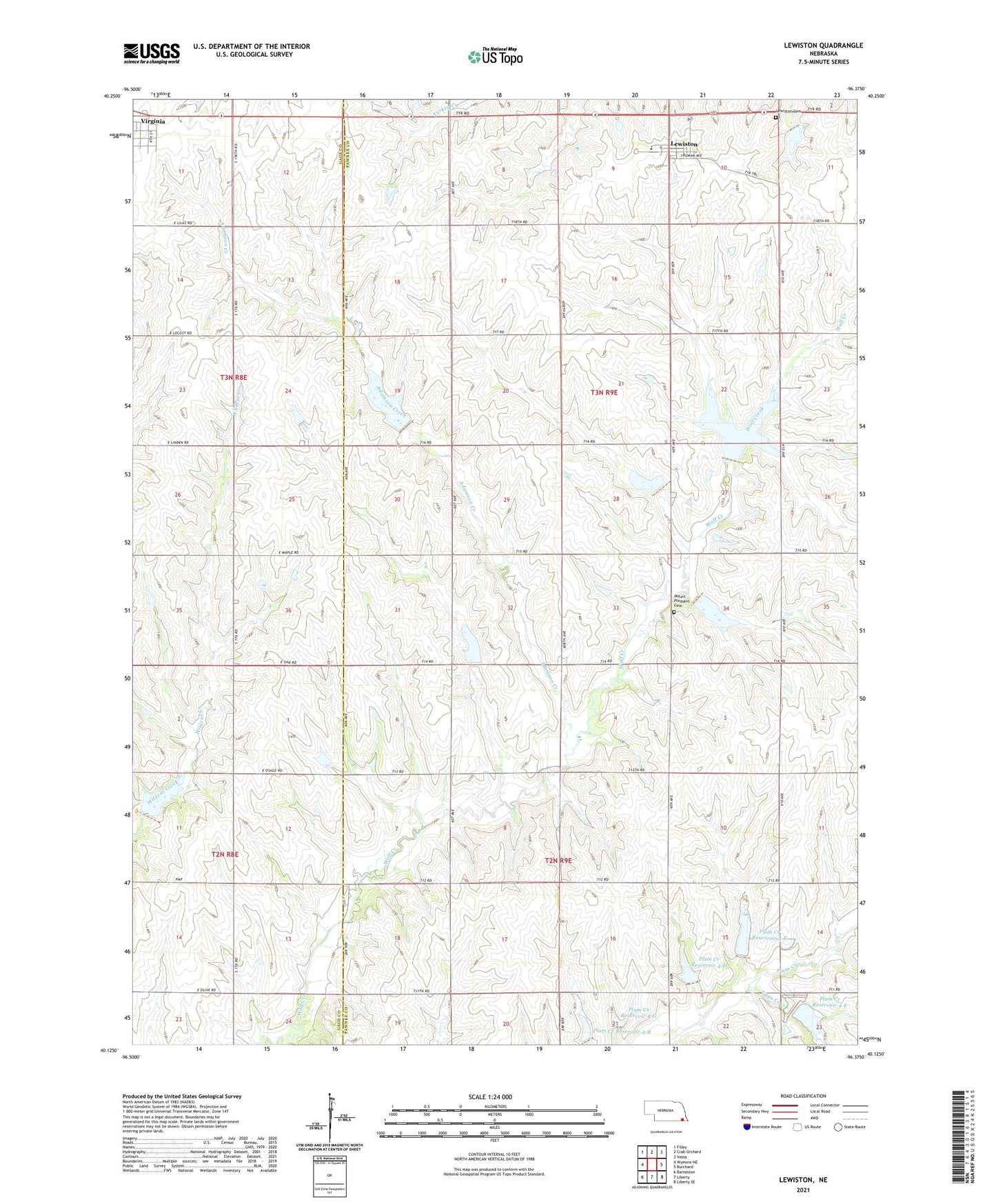
2021 topographic map quadrangle Lewiston in the state of Nebraska. Scale: 1:24000. Based on the newly updated USGS 7.5' US Topo map series, this map is in the following counties: Pawnee, Gage. The map contains contour data, water features, and other items you are used to seeing on USGS maps, but also has updated roads and other features. This is the next generation of topographic maps. Printed on high-quality waterproof paper with UV fade-resistant inks.
Quads adjacent to this one:
West: Wymore NE
Northwest: Filley
North: Crab Orchard
Northeast: Vesta
East: Burchard
Southeast: Liberty SE
South: Liberty
Southwest: Barneston
Contains the following named places: Adamson Creek, Election Precinct 7 Turkey Creek, Lewiston, Lewiston Cemetery, Lewiston Consolidated Schools, Lewiston Post Office, Mount Pleasant Cemetery, Pleasant Hill Church, Plum Creek, Plum Creek Dam 4-B, Plum Creek Dam 4-D, Plum Creek Dam 4-E, Plum Creek Dam 4-F, Plum Creek Dam 4-G, Plum Creek Reservoir 4-B, Plum Creek Reservoir 4-D, Plum Creek Reservoir 4-E, Plum Creek Reservoir 4-F, Plum Creek Reservoir 4-G, Southeast Nebraska Cooperative Elevator, Tate, Tate Post Office, Tipps Creek, Township of Plum Creek, Township of Turkey Creek, Village of Lewiston, Village of Virginia, Virginia, Virginia Post Office, Virginia School, ZIP Codes: 68323, 68380