MyTopo
Filley Nebraska US Topo Map
Couldn't load pickup availability
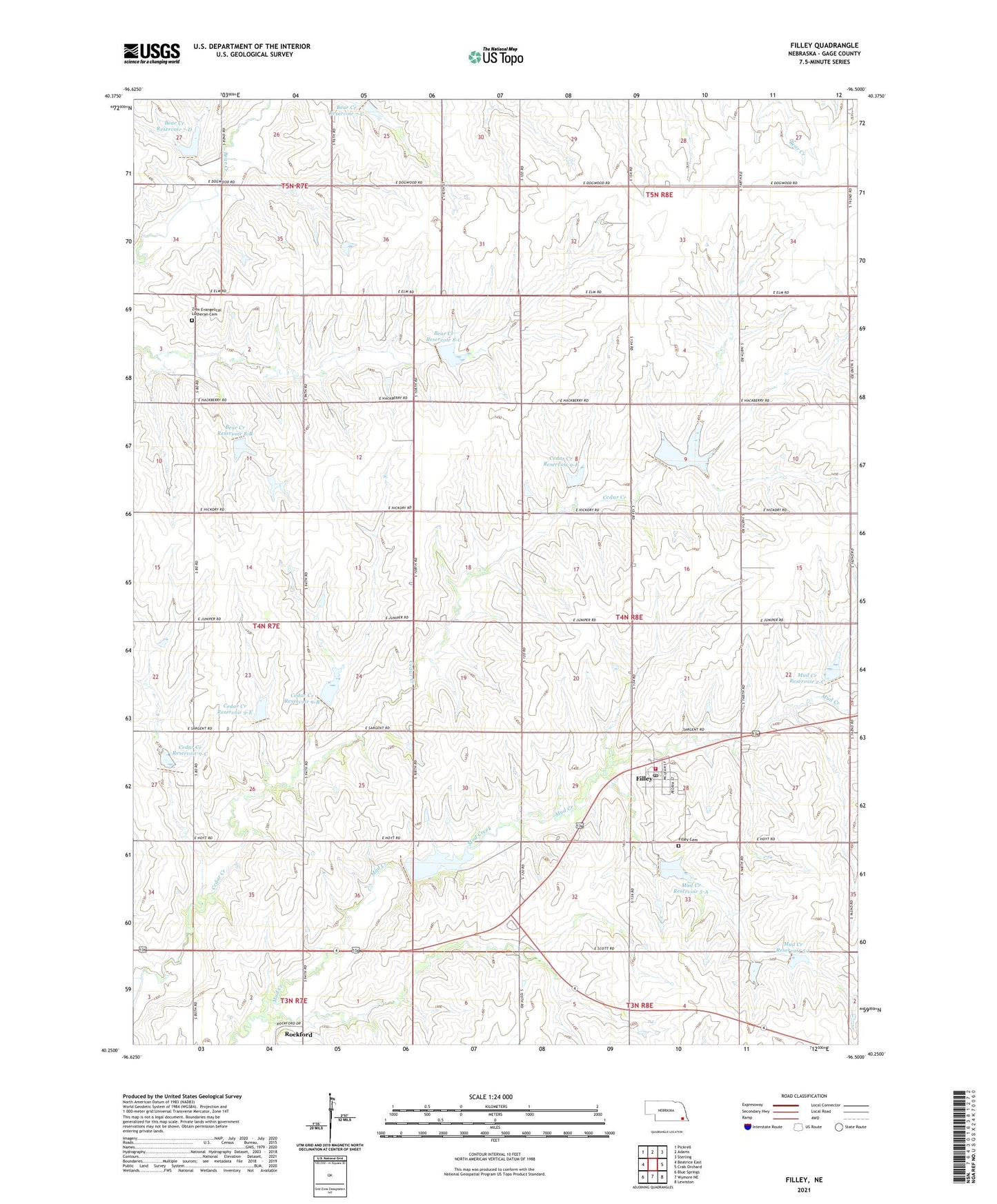
2021 topographic map quadrangle Filley in the state of Nebraska. Scale: 1:24000. Based on the newly updated USGS 7.5' US Topo map series, this map is in the following counties: Gage. The map contains contour data, water features, and other items you are used to seeing on USGS maps, but also has updated roads and other features. This is the next generation of topographic maps. Printed on high-quality waterproof paper with UV fade-resistant inks.
Quads adjacent to this one:
West: Beatrice East
Northwest: Pickrell
North: Adams
Northeast: Sterling
East: Crab Orchard
Southeast: Lewiston
South: Wymore NE
Southwest: Blue Springs
This map covers the same area as the classic USGS quad with code o40096c5.
Contains the following named places: Bear Creek Dam 7-C, Bear Creek Dam 7-D, Bear Creek Dam 8-B, Bear Creek Dam 8-C, Bear Creek Reservoir 7-C, Bear Creek Reservoir 7-D, Bear Creek Reservoir 8-B, Bear Creek Reservoir 8-C, Cedar Creek Dam 9-A, Cedar Creek Dam 9-B, Cedar Creek Dam 9-C, Cedar Creek Dam 9-E, Cedar Creek Dam 9-F, Cedar Creek Reservoir 9-A, Cedar Creek Reservoir 9-B, Cedar Creek Reservoir 9-C, Cedar Creek Reservoir 9-E, Cedar Creek Reservoir 9-F, Filley, Filley Cemetery, Filley Post Office, Filley Public Schools, Filley Rural Fire Protection District, Iron Horse Trail State Wildlife Management Area, Mud Creek Dam 2-A, Mud Creek Dam 2-C, Mud Creek Dam 5-1, Mud Creek Dam 5-A, Mud Creek Reservoir 2-A, Mud Creek Reservoir 2-C, Mud Creek Reservoir 5-1, Mud Creek Reservoir 5-A, Rockford, Rockford Post Office, Rockford School, Searcey Grain Company Elevator, Township of Filley, United Methodist Church, Village of Filley, Zion Church, Zion Evangelical Lutheran Cemetery, ZIP Code: 68357