MyTopo
Vesta Nebraska US Topo Map
Couldn't load pickup availability
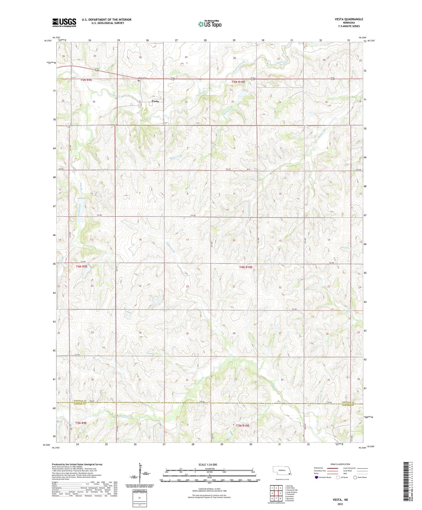
2021 topographic map quadrangle Vesta in the state of Nebraska. Scale: 1:24000. Based on the newly updated USGS 7.5' US Topo map series, this map is in the following counties: Johnson, Pawnee. The map contains contour data, water features, and other items you are used to seeing on USGS maps, but also has updated roads and other features. This is the next generation of topographic maps. Printed on high-quality waterproof paper with UV fade-resistant inks.
Quads adjacent to this one:
West: Crab Orchard
Northwest: Sterling
North: Saint Mary
Northeast: Tecumseh NW
East: Tecumseh
Southeast: Steinauer
South: Burchard
Southwest: Lewiston
This map covers the same area as the classic USGS quad with code o40096c3.
Contains the following named places: Brewers Branch, Hickory Ridge State Wildlife Management Area, Lost Branch, Maple Center School, Maple Grove Election Precinct, Saint Pauls Church, Sampson Branch, School Number 68, School Number 8, Stony Point School, Township of Maple Grove, Turkey Creek Post Office, Vesta, Vesta Cemetery, Vesta Post Office